
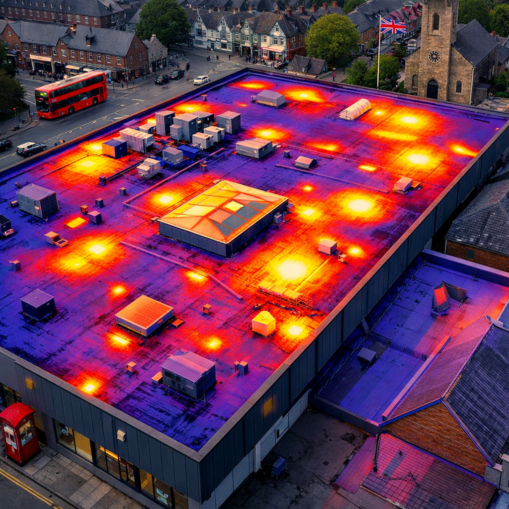
Finding a reliable partner for industrial drone inspection can feel like a gamble. You need speed, safety and data you can trust. In this article we compare the leading UK providers, show what to look for, and help you pick the right team for your commercial building projects.
1. Visual Perspectives , Our Pick for UK Commercial Inspections
We put Visual Perspectives at the top of our list. They run managed drone‑based aerial inspections across the United Kingdom. Their service covers roof and façade surveys, 3D mapping and thermal imaging. All work follows IEC 62446 standards, so the reports are ready for warranty claims and ESG reporting.
Why do we trust them? They are open about their £5 million liability cover and their ITC Level 1‑2 thermography credentials. That level of transparency is rare in this market. When you see a clear insurance figure, you know the risk is managed.
They also use a two‑person team on every job , a licensed CAA pilot and an engineer who knows what defects look like. That mix means you get images that are sharp and a report that tells you exactly what to fix.
“The data we get lets us plan repairs before they become emergencies,” says a facilities manager who works with Visual Perspectives.
Their drones capture high‑resolution RGB and radiometric thermal data in a single flight. The result is a “quickly, precise, and detailed” survey that skips scaffolding and saves weeks of work.
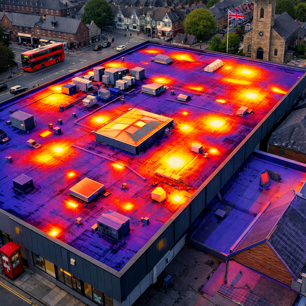
Imagine a warehouse roof that has hidden water pockets. Their thermal images spot the hot spots, the engineer notes the exact location and you can plan a repair before a leak drops on the floor.
They also feed the data into a cloud portal so you can track changes over time. That helps you prove ESG targets and keep insurers happy.
Drone Building Inspection – Visual Perspectives shows how the process works from start to finish.
Bottom line:Visual Perspectives gives you a full, compliant, and insured package that reduces risk and speeds decisions.
2. DroneInspect UK , Reliable Roof & Façade Surveys
DroneInspect UK focuses on roof and façade checks for big commercial buildings. They hold a CAA “Permission for Commercial Operations” (PfCO) and GWO certification for wind‑farm work.
What sets them apart is the ability to launch drones from moving vessels. That means they can reach offshore assets without a crane.
They use 4K cameras and thermal sensors to capture data fast. The flight plan is pre‑programmed, so the drone follows the same path every time. That repeatability makes it easy to compare new data with older surveys.
Clients say the reports are clear and colour‑coded. You can see a red hotspot on a roof and a green area that is fine. The visual format speeds decisions.
They store the GPS flight path, so you can replay the mission if you need to verify a measurement.
Their team can be on site within a day for many UK locations. That quick turnaround helps you keep projects on schedule.
DroneInspect also offers a cloud‑based dashboard where you can view orthomosaics, 3D models and thermal overlays side by side.
Building Defect Thermography – Visual Perspectives notes that thermal data is often the missing piece for roof health.
Because they work in offshore wind, they have experience with harsh weather and complex safety rules. That expertise translates well to large commercial roofs that sit on tall structures.
Bottom line:DroneInspect UK gives fast, clear surveys with a strong safety record, ideal for projects that need quick results.
3. SkyScan Solutions , High‑Resolution Thermal Imaging
SkyScan Solutions specialises in thermal imaging that can spot heat loss and panel defects. Their drones carry radiometric cameras that measure temperature to within 1 °C.
Thermal data is useful for both roof leaks and solar PV checks. The company says they can map a 50 MW solar farm in a single day.
They pair the drone data with AI software that flags hot spots automatically. That saves you hours of manual image review.
SkyScan follows the IEC TS 62446‑3 standard for solar inspections. That means the report meets the same rules as a hand‑held thermographer.
Clients get a digital twin of the site , a 3‑D model with thermal overlays. You can zoom in on a single panel and see the exact temperature.
They also offer a mobile app that lets technicians view the heat map on site, without a laptop.
Because the thermal camera is calibrated before each flight, the temperature readings stay accurate across seasons.
Here is a short video that shows a typical SkyScan inspection in action.
The video demonstrates how the drone flies a grid pattern, captures thermal slices and then stitches them together.
They provide a cloud portal where you can download the raw data, the processed map and the AI‑generated defect list.
UK CAA guidance on commercial drone operations backs the safety steps they follow.
Bottom line:SkyScan’s high‑resolution thermal imaging and AI reporting give you fast, accurate heat‑loss data for roofs and solar panels.
4. Aerial Diagnostics Ltd , 3D Mapping & Asset Management
Aerial Diagnostics focuses on creating 3‑D models and topographic maps. They use drones with LiDAR and photogrammetry to produce centimetre‑level accuracy.
For a large factory roof, a 3‑D model lets you see every ridge, gutter and equipment mount. You can measure slopes and plan drainage fixes without climbing the roof.
Their reports include orthomosaics, point clouds and a web viewer where you can walk around the model in a browser.
They also add thermal sensors, so you get a combined visual‑thermal 3‑D model. That helps you spot hot spots that sit behind a wall or under insulation.
Because they store the GPS flight path, you can run a change‑detection analysis. The software flags any new bulge or deformation that appeared since the last survey.
They work with a range of industries , from hospitals to logistics centres , so they know the health‑and‑safety rules that apply.
One client used their model to plan a roof‑renewal project and saved 15 % on material waste because they could cut panels to exact sizes.
Their equipment is maintained on a strict schedule, reducing the chance of a mid‑flight failure.
Equipment – Visual Perspectives highlights how keeping drones up‑to‑date improves data quality.
According to Wikipedia’s photogrammetry entry, modern drone photogrammetry can achieve sub‑centimetre accuracy, which matches the claims of Aerial Diagnostics.
Bottom line:Aerial Diagnostics gives you precise 3‑D data that turns a complex roof into a simple, measurable asset.
5. ThermoVision Drones , Specialized Solar PV Thermography
ThermoVision Drones focuses on solar panel farms. They fly drones equipped with radiometric cameras that meet IEC 62446 standards.
Their platform tags each panel with a unique ID, then maps temperature data onto a digital twin of the array. That lets you see exactly which modules are under‑performing.
They also use AI to classify defects , hot spots, cracked cells, disconnected strings , and generate a work‑order list that can be sent directly to your O&M team.
Because the data is georeferenced, you can import it into GIS or CMMS systems for long‑term tracking.
ThermoVision reports are IEC‑compliant, meaning they can be used for warranty claims and insurance documentation.
They claim a single drone can inspect up to 100 MW of panels in a day, which cuts inspection time dramatically.
Their software also predicts energy loss based on temperature differentials, giving you a quick estimate of potential revenue impact.
Clients have reported up to 30 % faster defect resolution after switching to ThermoVision’s automated workflow.
For more on the IEC 62446 standard, see Wikipedia’s IEC 62446 page.
Bottom line:ThermoVision offers a fast, AI‑driven solar thermography service that turns raw thermal data into actionable repair orders.
How to Choose the Right Industrial Drone Inspection Provider
Picking a partner is not just about price. You need skill, safety and solid reporting.
First, check the licences. The pilot should hold a CAA PfCO and have recent flight logs. Look for a team that includes an engineer or qualified inspector on site , a picture‑only service will miss hidden faults.
Second, verify compliance. The provider should follow IEC 62446 for solar work and have ITC thermography levels if you need heat‑loss data. Open insurance numbers are a good sign of professionalism.
Third, ask about data handling. Do they store the GPS flight path? Do they offer a cloud portal that lets you compare surveys over time? A good provider will give you both raw files and a clean report.
Fourth, review the reporting format. Look for clear defect descriptions, severity ratings and a priority list. A report that just dumps images will cost you time.
Finally, test their support. Can they mobilise a team within 24 hours? Do they have a clear escalation path if something goes wrong?
Bottom line:Use this checklist to compare providers and choose the one that matches your project’s safety and data needs.
FAQ
What is industrial drone inspection?
Industrial drone inspection uses unmanned aerial vehicles to capture high‑resolution visual and thermal data of large structures. The data helps you spot defects, measure heat loss and plan repairs without sending workers onto the roof.
Do I need a licence to hire a drone inspection service?
Yes. The provider must hold a CAA “Permission for Commercial Operations” (PfCO) and the pilots need a valid Remote Pilot Licence. This ensures the flight is legal and safe.
How accurate is thermal imaging for detecting roof leaks?
Thermal cameras can detect temperature differences as small as 1 °C. That allows you to see hidden moisture or insulation gaps that the naked eye can’t see.
Can drone data be integrated with my existing asset management system?
Most providers offer georeferenced data in common formats like CSV, GeoJSON or BIM. You can import the data into GIS, CMMS or BIM tools for ongoing asset tracking.
What safety measures are taken during a drone roof inspection?
Providers conduct risk assessments, use lightweight hexacopters or octocopters, and keep the drone within visual line of sight. They also follow strict maintenance logs and have emergency procedures in place.
How quickly can I expect a report after the flight?
Leading firms deliver a full report within 24‑48 hours. The report includes images, 3‑D models, thermal maps and a prioritized defect list.
Is drone inspection covered by insurance?
Professional drone services usually carry £5 million + public liability insurance. This protects both the operator and the client from accidental damage.
What types of buildings benefit most from drone inspections?
Large commercial roofs, flat‑top warehouses, hospital complexes and solar PV installations gain the most. The technology reaches hard‑to‑access areas safely and quickly.
Conclusion
Industrial drone inspection is now a must‑have tool for anyone managing commercial buildings or solar farms. It cuts time, saves money and uncovers what the naked eye can’t see. We’ve ranked the top UK providers , Visual Perspectives, DroneInspect UK, SkyScan Solutions, Aerial Diagnostics Ltd and ThermoVision Drones , and shown how to pick the right partner.
When you choose a provider, look for clear licences, solid insurance, IEC 62446 compliance and reports that turn raw data into clear actions. With the right data you can plan repairs, meet ESG goals and keep your assets running smoothly.
Ready to see the benefits for yourself? Reach out to a trusted partner today and let the drones do the risky work while you focus on keeping the building running.

