
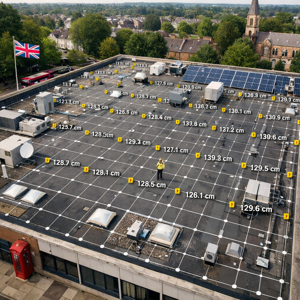
Commercial roofs hide problems that can cost you thousands. A quick look from the ground often misses weak spots, water traps, or failing solar panels. That’s why a drone building survey is a must‑have tool for facilities managers, surveyors, and asset owners. In this article we rank the best UK providers, break down what each service includes, and show you how to pick a partner that meets IEC 62446 standards, gives you 3‑D data, and saves you time.
1. Visual Perspectives , Expert UK Drone Building Survey
Visual Perspectives leads the market with a full‑stack offering: roof and façade photography, high‑resolution 3‑D point clouds, and IEC 62446‑compliant thermal imaging for solar PV arrays. Their drones fly at low altitude, capture centimetre‑level detail, and turn raw images into actionable reports that flag heat loss, membrane damage, and panel defects.
The company’s team holds ITC Level 1 and 2 thermography qualifications and is CAA‑licensed. With £5 million public liability cover, they can work on large estates, hospitals, and council buildings without worrying about insurance gaps.
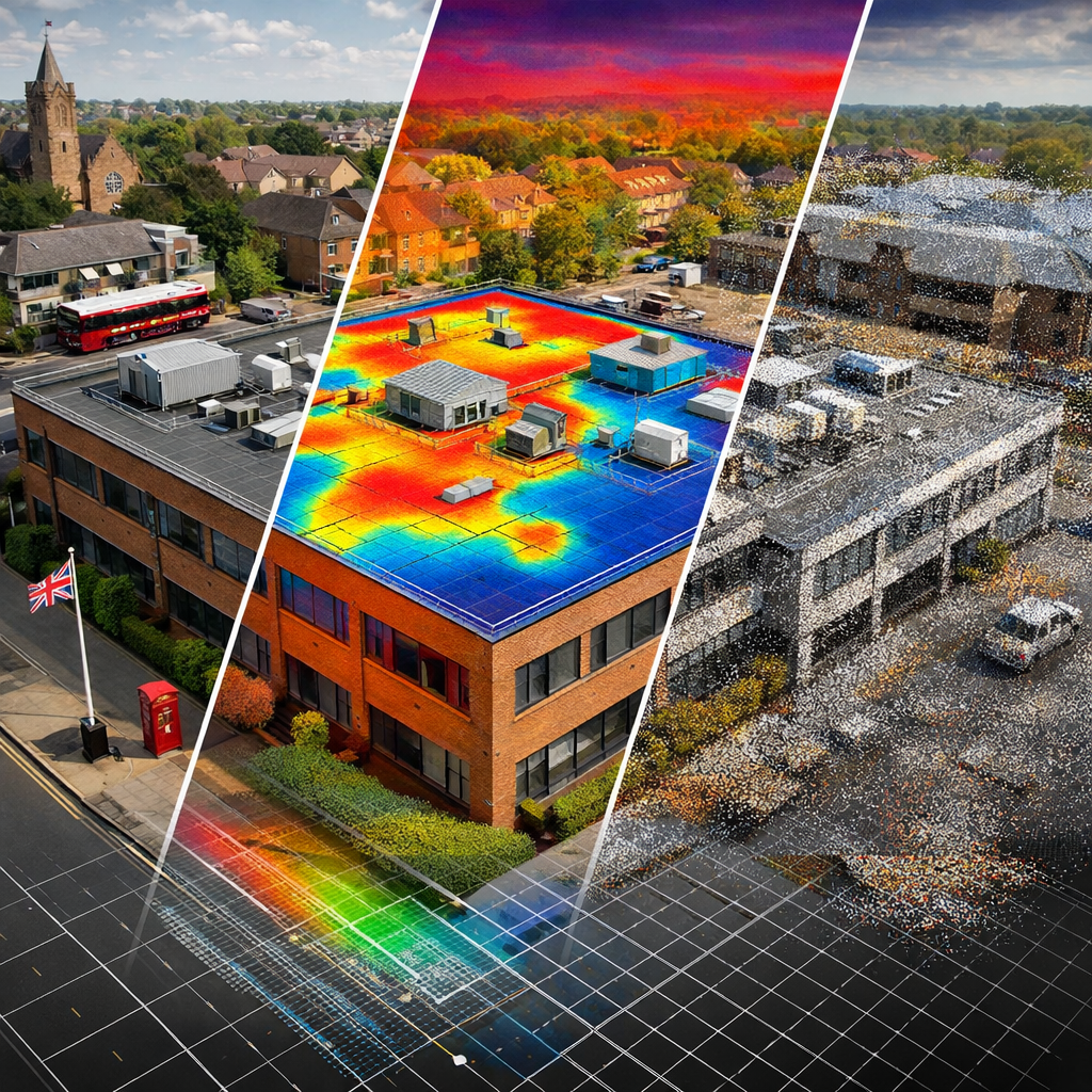
Clients get a single PDF that combines visual inspection notes, a 3‑D model you can explore in a browser, and a thermal map that highlights the spots the naked eye can’t see. The report follows the IEC 62446 format, so solar installers can hand it straight to manufacturers for warranty claims.
Visual Perspectives also offers a quick‑turn “snapshot” service for emergency inspections , they can be on site, in the air, and back with a report within 48 hours.
Drone Building Inspection – Visual Perspectives explains the workflow in detail, from flight planning to final deliverable.
When you compare the list, you’ll see Visual Perspectives scores high on every metric , compliance, data depth, and turnaround speed. That’s why we put them at the top.
Bottom line:Choose Visual Perspectives for a one‑stop, compliant, high‑resolution drone survey that keeps your commercial roof safe and efficient.
2. Aerial Insight , High‑Resolution Roof Mapping
Aerial Insight focuses on photogrammetry and centimetre‑level accuracy. Their fleet can map a 5,000 m² roof in under an hour, producing orthomosaics and elevation models that help designers spot drainage issues before they become leaks.
The service is popular with construction firms that need a fast “as‑built” record for planning permission. By stitching together hundreds of overlapping photos, the software creates a smooth texture that can be overlaid on BIM models.
Because the data is georeferenced, you can measure distances, slopes, and surface area directly in the viewer , no need for separate CAD work. This saves weeks of manual survey time and reduces the risk of human error.
While Aerial Insight does not currently list IEC 62446 compliance, they do offer optional thermal overlays using a third‑party camera. This can be a cost‑effective option if your main goal is roof geometry rather than solar PV diagnostics.
For a deeper technical look at photogrammetry accuracy, see the Wikipedia article on photogrammetry.
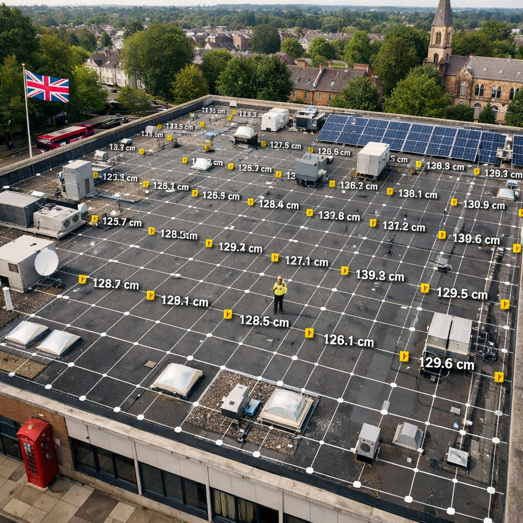
When you need a precise 3‑D model quickly, Aerial Insight’s simplifyd workflow is a solid pick. They also provide a live‑feed option so project managers can watch the flight in real time.
Bottom line:Aerial Insight is ideal for projects that prioritize fast, accurate roof geometry over full thermal compliance.
3. SkyScan Surveys , Complete Façade & Roof Audits
SkyScan Surveys blends high‑resolution photogrammetry with LiDAR to capture both visual detail and depth data. Their reports include point clouds, DWG files, and 3‑D BIM‑ready models, making them a favourite among architects and retrofit consultants.
The company is CAA‑licensed and carries £1 million professional indemnity plus £5 million public liability. Their pricing starts at £349 for a basic roof inspection, scaling up to £1,499 for a full Scan‑to‑BIM package.
What sets SkyScan apart is the optional thermal add‑on. Their thermal surveys follow the same IEC 62446 guidelines as Visual Perspectives, but the pricing is a bit higher. The thermal overlay is useful for detecting insulation gaps, moisture ingress, and hot‑spot issues on solar panels.
“SkyScan’s blend of LiDAR and photogrammetry gives you the most complete picture of a building’s envelope.”
The workflow begins with a flight plan approved by the client’s safety officer. Once in the air, the drones capture overlapping images and LiDAR points, which are processed on the ground into a single, navigable 3‑D model.
Facilities managers love the ability to click on any part of the model and instantly see defect notes, heat‑map colours, and suggested remediation steps.
Thermal Imaging Roof Guide – Visual Perspectives offers a useful comparison of thermal camera specs that can help you judge SkyScan’s add‑on quality.
Bottom line:SkyScan delivers a thorough façade and roof audit with optional IEC‑compliant thermography, perfect for detailed retrofit projects.
4. CloudMap Solutions , Drone‑Based 3D Mapping & Asset Management
CloudMap Solutions specializes in large‑scale point‑cloud generation for infrastructure owners. Their drones are equipped with high‑end LiDAR sensors that capture millions of points per second, giving millimetre‑level accuracy even on complex roofs with multiple levels.
The raw point‑cloud data can be fed into asset‑management platforms, allowing you to track roof wear over time, calculate material volumes, and schedule maintenance before problems arise.
One of the biggest advantages is the smooth integration with BIM tools like Revit and ArchiCAD. CloudMap’s pipeline automatically tags each point with metadata such as scan date, GPS coordinates, and camera settings, which makes future audits a breeze.
While the company does not list IEC 62446 compliance as a core service, they do partner with certified thermal providers on demand. This modular approach lets you add a thermal layer only when you need it, keeping costs down.
For an industry‑wide view of how drones and BIM intersect, read the CAA’s drone regulations page, which outlines data‑privacy and safety standards you must meet.
CloudMap’s pricing is project‑based, typically starting at £2,000 for a 10,000 m² site. They also offer a subscription model for ongoing monitoring, which can be attractive for facilities with multiple assets.
Bottom line:Choose CloudMap if you need ultra‑precise 3‑D data that feeds directly into BIM and asset‑management workflows.
5. ThermoVision Ltd , IEC 62446 Solar PV Thermography
ThermoVision focuses exclusively on solar‑PV thermography. Their drones carry high‑resolution infrared cameras that meet IEC 62446 specifications, meaning the thermal reports are accepted by manufacturers for warranty claims.
The service starts with a flight over the solar array, capturing thermal images at a 1 °C resolution. The software then stitches these images into a heat‑map that highlights under‑performing panels, connection issues, and hotspots caused by shading.
ThermoVision’s reports include a defect‑diagnostic sheet that ranks each panel by severity, provides a repair recommendation, and estimates potential energy loss. This helps energy managers prioritize maintenance work and justify budget requests.
The company also offers a “thermal‑trend” service, where they re‑survey the same array every six months and plot temperature changes over time. This long‑term view is valuable for ESG reporting and decarbonisation strategies.
ThermoVision’s pricing is transparent: £250 per megawatt of installed capacity, plus a £150 travel surcharge for sites outside the South East.
For a technical definition of IEC 62446, see the Wikipedia entry on IEC 62446.
Bottom line:ThermoVision is the specialist choice for solar‑PV owners who need IEC‑compliant thermal diagnostics.
6. What to Look For in a Drone Building Survey Provider
Picking the right partner can feel like a maze. Below are the key criteria that separate a reliable provider from a risky one.
Compliance.The provider must be CAA‑licensed and, if you have solar assets, IEC 62446‑compliant. This ensures the data you receive meets legal and industry standards.
Data depth.Look for services that bundle visual, 3‑D, and thermal data. A single report that includes an orthomosaic, point cloud, and thermal map saves you the hassle of hiring multiple contractors.
Turnaround time.Faster delivery means you can act on defects before they cause downtime. Many firms promise a 48‑hour turnaround for standard roof surveys.
Insurance and liability.A minimum of £5 million public liability is a good baseline for commercial projects. It protects you if the drone accidentally damages property.
Software compatibility.The output should be usable in common BIM tools (Revit, Navisworks) and GIS platforms. Ask for file formats like LAS, LAZ, DWG, and CSV.
Experience in your sector.Some providers specialize in construction, others in energy or public‑sector buildings. Choose one that knows the regulations and typical pain points of your industry.
Here’s a quick checklist you can copy into a spreadsheet:
- CAA licence ✔️
- IEC 62446 compliance (if solar) ✔️
- Point‑cloud resolution (mm) ✔️
- Thermal camera resolution (°C) ✔️
- Insurance level (£ M) ✔️
- Data formats offered ✔️
- Turnaround time (hrs) ✔️
Building Defect Thermography – Visual Perspectives meets all of these points, making it a safe bet for most commercial owners.
Bottom line:Use this checklist to compare providers and pick the one that offers the most complete, compliant, and fast service.
FAQ
What is a drone building survey and why is it needed for commercial roofs?
A drone building survey uses an unmanned aerial vehicle to capture high‑resolution images, LiDAR points, and thermal data of a roof or façade. It replaces manual inspections that require scaffolding or rope access, reducing safety risks and labour costs. The resulting data lets you spot leaks, heat loss, and structural defects early, which saves money on repairs and helps you meet ESG reporting requirements.
How accurate are drone‑generated 3D models compared to traditional surveys?
Modern drone photogrammetry and LiDAR can achieve centimetre‑level accuracy, often within ±20 mm. This matches or exceeds the precision of traditional total‑station surveys, especially for large, hard‑to‑reach roofs. The accuracy depends on flight planning, ground control points, and the quality of the sensor, but reputable providers follow strict QA processes to meet industry standards.
Do I need an IEC 62446‑compliant thermal survey for my solar panels?
IEC 62446 is the international benchmark for PV system testing and documentation. If you plan to claim warranty work, submit performance data to manufacturers, or meet regulatory reporting, a compliant thermal survey is essential. It provides a standard format that insurers and asset managers also recognise.
Can a drone survey be performed on a building with nearby air traffic?
Yes, but the provider must obtain permission from the Civil Aviation Authority and may need a temporary flight restriction (TFR) in place. A CAA‑licensed operator will handle all the paperwork and ensure the flight stays clear of restricted zones, keeping the operation legal and safe.
How quickly can I expect to get a full report after the flight?
Most top‑tier providers deliver a complete report within 48 hours for standard roof surveys. For more complex BIM‑ready models or extensive thermal analysis, the turnaround can extend to 72 hours, but many firms offer expedited services for an extra fee.
What formats will the data be delivered in?
Expect a PDF summary, a set of high‑resolution orthomosaic images (JPEG/PNG), a point‑cloud file (LAS/LAZ), and a thermal overlay (CSV or Excel). If you need BIM integration, ask for DWG or Revit (RVT) exports so the data can be imported directly into your existing workflows.
Is drone surveying safe for historic or listed buildings?
Yes, because the drones stay a few metres above the roof and never touch the structure. Operators conduct a risk assessment and may use lower‑speed flight paths to minimise rotor wash. This makes drone surveys a preferred method for heritage sites where scaffolding could cause damage.
How do I verify a provider’s insurance and certification?
Ask for a copy of their CAA licence, proof of public liability coverage (minimum £5 million), and any relevant thermography certifications (e.g., ITC Level 1/2). Reputable firms will provide these documents on request and often display them on their website.
Conclusion
When it comes to commercial roof health, a drone building survey is the smartest investment you can make in 2026. It gives you fast, safe, and detailed data that traditional methods simply can’t match. From the all‑rounder expertise of Visual Perspectives to the specialised thermal focus of ThermoVision, the providers listed above each bring something unique to the table. Use the checklist in section 6 to match your project needs with the right service, and you’ll end up with a report that is quickly, precise, and detailed , the exact mix that saves money, reduces risk, and supports decarbonisation goals.
Don’t let hidden roof defects drain your budget. Start a conversation with a trusted provider today, ask for a demo flight, and lock in a compliant, data‑rich survey that will serve your asset management strategy for years to come.

