
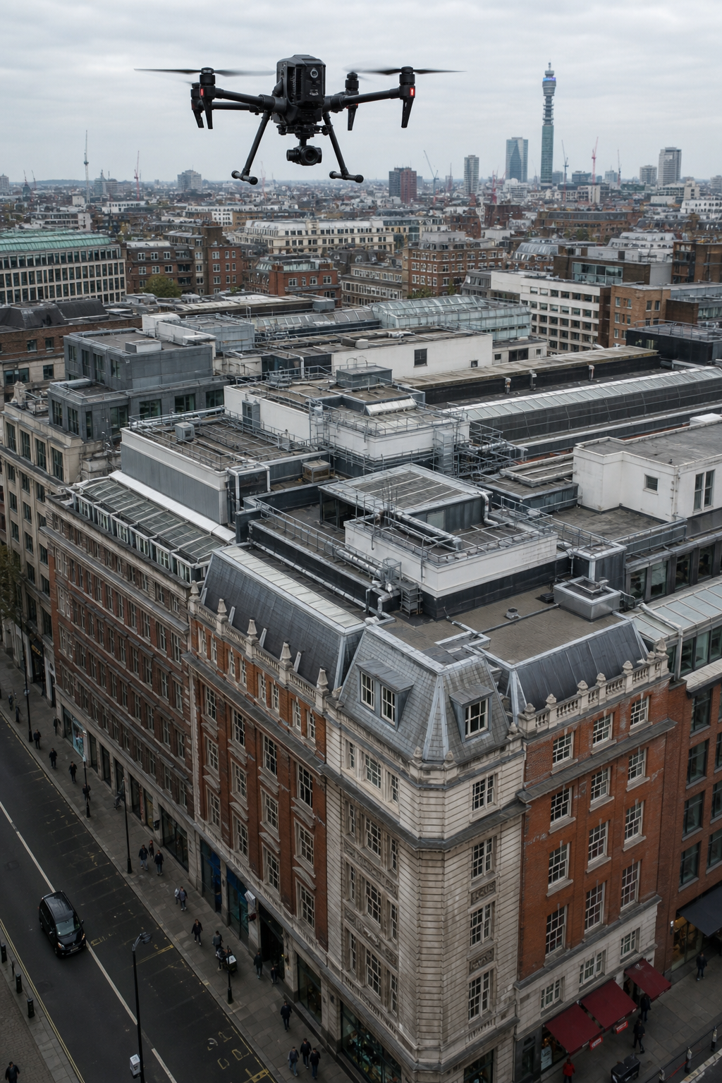
Ever wonder why a drone survey can cost anywhere from a few hundred pounds to several thousand? Let’s cut through the jargon, break down the real cost drivers, and show you how to budget smartly for the exact data you need. We’ll cover typical price ranges, what affects them, how drone surveys compare to traditional methods, and how to get a strong return on your investment. If you manage commercial buildings in the UK, this guide is for you.
What Does a Drone Survey Cost? Typical Price Ranges
, the median hourly rate for a UK drone survey sits at around £275. But that’s just the middle point. Most quotes fall between £150 and £400 per hour. Some providers charge as little as £35 per acre for large-area mapping, while high-end per-capture contracts can reach $1,250 (roughly £1,000) for premium deliverables like RTK-accurate point clouds and orthomosaics.
The only sub-£100 hourly rate in the data is flagged as a “Low-Cost Warning Rate”. That means unusually cheap quotes may hide compliance or quality issues. You should always check that your provider is CAA-approved, holds at least £5 million insurance, and follows industry best practices. Most standard surveys for commercial buildings start around £300, £500 for a small site. For larger properties, per-acre pricing can drop to £35, £150, but you’ll pay extra for processing (£20, £50 per acre).
Bottom line: Expect to pay £150, £400 , with large projects benefiting from per-acre rates that reduce overall cost.
Key Factors That Affect Drone Survey Pricing
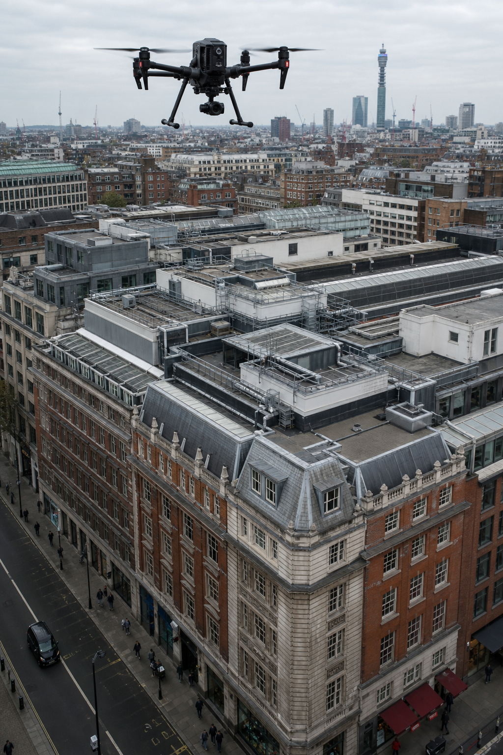
Several variables push the price up or down. The biggest is site complexity. A flat roof on a modern building might take 30 minutes. A Victorian structure with multiple roof levels, parapets, rooflights, and plant equipment could take over two hours. Every junction, penetration, and change in direction needs careful inspection. That eats up flight time and processing work.
Deliverables required also matter. A simple photo set costs less than an orthomosaic with thermal overlays. A full 3D point cloud with RTK accuracy requires expensive sensors and hours of post-processing. High-end mapping services charge $600, $1,250 per capture precisely because of the data intensity.
Mileage and travel time are often hidden costs. Many providers charge 45p per mile for sites beyond a 30, 50 mile radius. If your building is in a remote area, this surcharge can add £100, £200 to the total bill. Ask upfront whether travel is included.
Compliance and insurance add to legitimate costs. A CAA-qualified operator with £5 million public liability insurance and ITC-certified thermography training (like Visual Perspectives) will charge more than a weekend hobbyist. But you get reliable, defensible data , and peace of mind. As one industry guide notes, “The cheapest hourly offers (£50, £100) are flagged as non-compliant, so clients should weigh price against regulatory risk.”
Bottom line: A thorough drone survey cost depends on the building’s unique features, the data you need, and the provider’s credentials.
Drone Survey vs Traditional Survey Methods
Traditional roof inspections rely on scaffolding, cherry pickers, or rope access. For a medium-sized commercial building (say, 1,000 sq m), scaffolding can cost £3,000, £10,000 just for setup , plus the survey time. A drone survey on the same building is typically £500, £1,500 and takes less than half a day. No scaffolding. No disruption to tenants or operations.
Safety is another big factor. Drones eliminate the need for people to work at height. According to the Health and Safety Executive, falls from height cause nearly 30% of fatal workplace injuries in construction. By keeping boots on the ground, drone surveys drastically cut risk.
Accuracy is comparable or better. Modern drones with RTK GPS and high-res cameras can produce centimetre-level precision, matching the output of traditional theodolite surveys. And you get a permanent visual record , 4K photos, thermal images, and 3D models , that can be re-examined years later. A traditional written report can’t give you that.
But there are limits. Drones can’t inspect under roof membranes, inside cavities, or behind cladding. For those, you still need intrusive inspections. However, the drone survey identifies exactly where to drill, saving time and money on unnecessary openings. A study by Aerotas found that combining drone data with targeted ground checks reduced total survey costs by 30-50% on many projects.
For a drone building inspection, you get a quicker, safer, and often more complete picture than from the ground. That’s why more facilities managers and building surveyors are switching.
Bottom line: Drone surveys are typically 50, 70% cheaper than scaffolding-based inspections for commercial buildings, with faster turnaround and better safety.
How Deliverables Influence Drone Survey Costs
What you get from a drone survey directly affects the price. Let’s break down the common output types and what they typically cost.
- Basic photo/video package, 20, 50 high-res images plus a short video. Usually £200, £500 for a small commercial roof. Minimal post-processing.
- Orthophoto / orthomosaic, A geometrically corrected aerial map stitched from hundreds of images. Adds £100, £300 for processing.
- Thermal images, Reveal heat loss, moisture, and electrical hotspots. Requires radiometric cameras (£500, £1,000 surcharge) and certified thermographers. Visual Perspectives uses ITC Level 1 & 2 trained experts.
- 3D point cloud or model, Used for volume calculations, structural analysis, and BIM integration. Needs RTK drone and specialised software. Per-capture pricing of $600, $1,250 is common for these deliverables.
- IEC 62446 compliant solar PV report, Combines thermal and visual inspection of each solar module. Typically £500, £1,500 for a commercial rooftop array. Includes defect classification and repair recommendations.
Each additional output adds hours of data processing. A simple inspection might generate 50 images. A full 3D survey can create a dataset of 500+ images and a point cloud with millions of points. Processing that takes powerful computers and skilled operators. That labour is reflected in the price.
Bottom line: The more detailed and processed your deliverables, the higher the drone survey cost , but you get actionable data that can save far more in avoided repairs and downtime.
Calculating ROI on Drone Surveys for Commercial Buildings
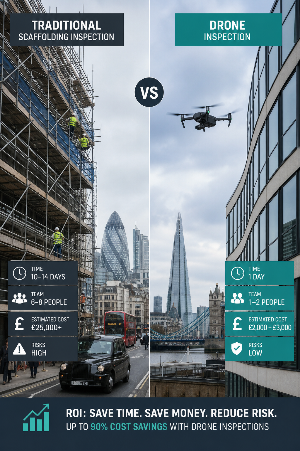
Return on investment isn’t just about money saved on access equipment. It’s about faster decisions, fewer safety incidents, and longer asset life. Let’s use a real example from the research material: a 20-storey office building renovation. Traditional inspections required extensive scaffolding , setup cost alone was £30,000. Drones reduced inspection time by 60% and cut labour costs by 30%. The project saw a 25% overall improvement in ROI.
For a typical UK commercial building (say, 5,000 sq ft flat roof), a traditional survey with scaffolding might cost £4,000, £6,000 and take two days. A drone survey costs £800, £1,500 and takes two hours. That’s a 70% saving on the inspection itself. But the real value comes from early defect detection. A thermal drone can spot water ingress below a membrane before it causes structural damage. Catching a leak early might save £20,000 in repairs versus a full replacement.
Consider solar PV arrays. A drone commercial solar panel inspection with thermal imaging (IEC 62446 compliant) costs around £500, £1,500. If it identifies a single faulty bypass diode causing a 10% power drop across a 250 kW array, the lost energy over a year could be worth £5,000, £10,000. Fixing that diode costs a few hundred pounds. The inspection pays for itself in weeks.
Hidden ROI factors: Insurers often offer lower premiums for properties with regular drone survey records. And for compliance-driven projects like RAAC assessments or cladding inspections, drone data provides an auditable trail that satisfies regulators without expensive intrusive surveys.
Bottom line: Drone surveys typically deliver a 3:1 to 5:1 return on cost when factoring in time savings, risk reduction, and early defect detection.
Drone Survey Costs for Solar PV and Roof Inspections
Solar PV inspections are a growing speciality. Drones equipped with radiometric thermal cameras can scan an entire commercial rooftop array in a single flight. The typical drone survey cost for a solar PV inspection ranges from £500 to £1,500, depending on array size and access restrictions. This includes a full thermographic report compliant with IEC 62446(the international standard for grid-connected PV system testing).
Why is it worth it? A single hot spot caused by a micro-crack or failed bypass diode can reduce string output by 20-30%. Over a 100 kW array, that’s thousands of pounds in lost revenue each year. The inspection cost is recouped within months once the faulty modules are replaced.
For roof inspections generally , whether flat or pitched, felt or single-ply , drone surveys cost roughly the same as solar inspections. A standard roof condition survey for a commercial building of 2,000 sq m starts at around £500, £800. If you need thermal overlays to find hidden moisture, add £200, £400. For full 3D mapping with volume calculations (e.g., for roof replacement planning), expect £1,000, £2,500.
Key point: Whether you’re checking for storm damage, planning maintenance, or verifying a new installation, the cost is a fraction of the potential repair bill. Visual Perspectives provides drone thermal imaging that reveals what the naked eye can’t see , quickly, precisely, and in detail.
Bottom line: For solar PV and roof inspections, budget £500, £1,500 for a thorough, compliant drone survey that typically pays for itself through fault detection.
Frequently Asked Questions
What is the average drone survey cost for a commercial building in the UK?
The average hourly rate is around £275, with most quotes falling between £150 and £400 per hour. For a typical commercial roof (1,000, 2,000 sq m), you can expect a total cost of £500 to £1,500 for a standard inspection with photos and a report. Larger sites or 3D mapping can cost £2,000, £5,000+.
Why are some drone surveys so cheap?
Very low quotes (under £100 per hour) often indicate a non-compliant operator , no CAA license, insufficient insurance, or lack of pros may produce poor quality data and leave you liable for regulatory breaches. Always verify credentials before booking a cheap service.
Do I need thermal imaging for a roof survey?
Not always, but it’s highly recommended for flat roofs and solar arrays. Thermal imaging detects moisture trapped under membranes, missing insulation, and electrical faults invisible to the naked eye. Adding thermal capability usually costs £200, £500 extra but can uncover defects that save thousands in repairs.
How long does a drone survey take?
Most commercial roof surveys take 1, 2 hours on site for the flight itself. Add travel time and 1, 3 days for data processing and report generation. For simple inspections with basic photos, you might get the report within 24 hours. For full 3D models, expect up to a week.
Can a drone survey replace walking the roof?
For visual inspections, yes , drones provide a faster, safer view. But they cannot inspect under surfaces or inside cavities. The best approach combines a drone survey with targeted intrusive checks at the exact spots flagged by the drone. This hybrid method is both cost-effective and thorough.
Is drone survey data accepted by insurers and building regulators?
Yes, when conducted by a qualified provider with proper certification (CAA, ITC thermography, IEC 62446 compliance). Many insurers now recommend drone surveys for periodic property inspections, and the data is admissible in warranty claims and compliance audits. Always ask for a professional report with traceable data.
What should I look for in a drone survey provider?
Check for CAA permission for commercial operations, at least £5 million public liability insurance, ITC Level 1 or 2 thermography certification (if thermal is needed), and experience with commercial buildings. Ask to s and case studies. A good provider will offer a fixed quote after a desk-based assessment.
How do I get an accurate quote for my building?
Provide the property address, roof type (flat/pitched), approximate square footage, and your required deliverables (photos, thermal, 3D model). Reputable providers will use satellite imagery to assess complexity and give you a firm price before the site visit. That’s what Visual Perspectives does for every project.
Conclusion
Understanding drone survey cost is the first step to making a smart investment in your building’s health. We’ve seen that prices range from £150, £400 per hour for quality work, with total costs typically £500, £1,500 for a standard commercial roof inspection. The key factors are site complexity, deliverables, travel, and provider credentials , not just roof size. Compared to traditional scaffolding surveys, drones are quicker, safer, and often 50, 70% cheaper. The ROI is clear when you factor in early defect detection, reduced downtime, and better compliance.
If you manage a commercial property in the UK, a drone survey is one of the most cost-effective tools you can use. You’ll get precise data fast, without disrupting your tenants or breaking the bank. Ready to could save your building? Contact Visual Perspectives today for a free, no-obligation quote. We’ll assess your site remotely and provide a fixed price within 24 hours. Our team has over 20 years of experience, CAA compliance, ITC-certified thermography, and £5 million insurance. Let us help you see what the naked eye can’t see.

