
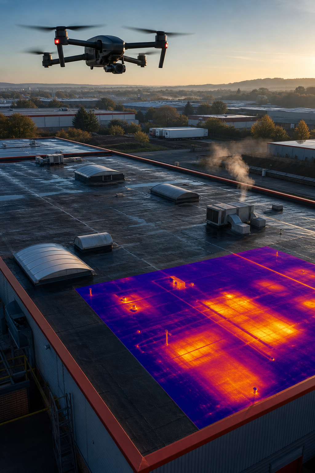
Flat roofs hide a lot of trouble. Water leaks, heat loss and structural flaws stay hidden until they cause big damage. A drone can spot those problems in minutes, not days. In this article you’ll see the eleven UK services that specialise in flat‑roof drone surveys for commercial and public buildings, learn why compliance matters, and get a quick checklist to pick the right partner.
1. Visual Perspectives , Our Pick for UK Commercial Drone Surveys
We start with Visual Perspectives Limited because they cover every box that matters for a commercial flat‑roof job. Their drones fly under full CAA approval, they carry £5 million public‑liability insurance and they hold ITC Level 1 & 2 thermography credentials. The team also produces IEC 62446‑compliant reports , a rare combo that insurers and energy managers demand.
What you get is a “quickly, precise, and detailed” survey that shows you what the naked eye can’t see. The flight plan is built around the roof’s size, the surrounding structures and the best time of day for thermal contrast. Data is captured in high‑resolution RGB and a FLIR thermal sensor, then stitched into a 3‑D model and a heat‑map. The report lists every defect, gives a severity rating and recommends repair steps.
Because the service is fully managed, you never need a ladder crew or a scaffolding hire. That alone cuts project costs by up to 70% on large estates. The team also integrates the model into BIM or FM software, so asset managers can track issues over time.
Clients range from NHS trusts to local authority housing estates. They trust us to keep their roofs safe and their insurance premiums low. Drone Building Inspection – Visual Perspectives explains how the process works in detail.
And the data is ready to share with insurers, engineers or compliance officers in minutes.
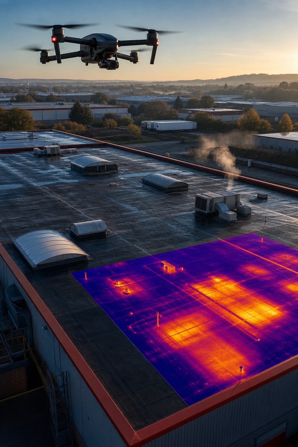
Bottom line: Visual Perspectives gives you the full package , compliance, insurance and data , in one contract.
2. Specialist Solar PV Thermography Firms
Solar‑panel owners need more than a visual check. Heat‑loss and hidden moisture can wreck an array before it even starts producing. Specialist thermography firms use drones equipped with FLIR cameras to scan every panel, every inverter and every mounting bracket.
These firms often work with MCS‑certified installers, so they understand the load‑bearing limits of flat roofs. A typical survey captures a thermal image at sunset, when the panels are cooling and any hot spots stand out. The report flags mismatched temperatures that could indicate poor electrical connections or shading issues.
Because the data is IEC 62446‑compliant, it can be handed straight to a solar EPC for warranty purposes. The report also notes any roof membrane damage that could affect panel mounting.
Many firms also offer a follow‑up inspection after the first year of operation, letting you track performance drift over time.
Imagine if a hotspot shows a 5 °C rise on a single panel. You can replace that panel before it fails and avoid costly downtime.
These specialists are a solid choice when your priority is solar‑panel performance and warranty compliance.
3. CAA‑Approved Drone Roof Survey Operators
Regulation matters. The UK Civil Aviation Authority (CAA) sets strict rules for commercial drone flights. Operators that hold a CAA Operator ID and a General Visual Line‑Of‑Sight (VLOS) certificate can fly over populated areas, near power lines and over high‑rise structures without special permits.
One provider listed on Drone Roof Surveyors offers a full CAA‑approved service for South Wales and beyond. Their pilots log flight hours, maintain calibrated sensors and keep a visual observer on the ground. This reduces the risk of a flight breach and keeps your project on schedule.
CAA compliance also means insurance carriers view the data as reliable. A claim adjuster can trust that the images were captured legally and safely.
When you choose a CAA‑approved operator, you also get a clear flight plan that respects local airspace restrictions. That avoids costly delays.
Overall, a CAA‑approved operator adds a layer of legal safety that many generic drone services lack.
4. Integrated Building Diagnostics Providers
Some companies go beyond a simple roof picture. Integrated diagnostics providers combine visual, thermal and 3‑D scanning to give a full health check of the building envelope.
RAM Building Consultancy, for example, uses drones that capture up to 4K video, thermal data and photogrammetric point clouds. Their reports include defect locations, material condition notes and even a digital twin you can walk through on a tablet.
Because they are RICS‑regulated, their findings carry weight with architects, surveyors and insurers alike. They also tie the data into FM software, so you can schedule maintenance tasks directly from the model.
Clients often use this service when they have mixed‑material roofs , EPDM, TPO and built‑up sections side by side. The drone can spot the exact spot where a membrane has lifted, saving you from costly blanket repairs.
And the data is delivered in formats that BIM managers love , IFC, OBJ and Revit‑compatible files.
For a dees work, page.
You’ll be in good hands with a provider that links the survey to your existing asset‑management workflow.
5. Insurance‑Compliant Roof Inspection Services
Insurance companies often ask for a recent roof condition report before they renew a policy. A survey that meets their documentation standards can keep premiums low and claims fast.
Full View Ltd publishes a clear, insurer‑friendly report that includes high‑resolution orthomosaics, annotated defect photos and a risk rating. Their drones carry a 20‑megapixel camera, so every crack and blister is captured to the centimetre.
The service also offers a thermal add‑on, which helps spot hidden water ingress that could cause mold , a common cause of claim disputes.
Because they do not perform repairs themselves, there is no conflict of interest. The report is a neutral assessment that insurers trust.
In practice, a property manager can upload the PDF to the insurer’s portal within 24 hours of the flight. That speeds up policy renewal and reduces the chance of a coverage gap.
When you need a document that satisfies both building control and insurance requirements, look for a provider that offers an “insurance‑compliant” label.
Bottom line: An insurance‑compliant survey protects you from unexpected premium hikes.
6. Multi‑Sensor Survey Companies (Thermal + LiDAR)
When roof geometry is complex , many parapets, skylights or HVAC units , a single camera can miss shadows or distortion. Multi‑sensor providers pair thermal imaging with LiDAR to map every contour.
Sky Scan Surveys flies a DJI Matrice equipped with a LiDAR scanner and a FLIR thermal camera. The LiDAR creates a precise point cloud, while the thermal overlay highlights moisture or heat loss.
This combo is especially useful for heritage buildings where you cannot place ladders. The LiDAR can capture the roof’s shape from a safe distance, and the thermal data shows where the old membrane might be failing.
Because the data is georeferenced, you can import it into GIS tools for flood‑risk analysis or solar‑panel layout planning.
Clients often appreciate the single‑flight approach , they get a 3‑D model, a heat‑map and a defect list in one go.
Choosing a multi‑sensor provider reduces the need for a follow‑up visit, saving time and money.
7. Pre‑Installation Solar Roof Condition Specialists
Before you bolt a solar array onto a flat roof, you need to know if the roof can bear the load and if the membrane is intact.
Drone Site Surveys runs a pre‑installation check that captures high‑resolution RGB images, thermal data and a detailed surface measurement. The pilot flies low enough to see the membrane texture, yet high enough to stay clear of any nearby power lines.
The report includes a load‑bearing analysis based on the roof’s construction type and current condition. It also flags any ponding water that could corrode panel brackets.
Because the survey is done before any scaffolding is erected, the installation team can plan mounting points with confidence. That cuts the risk of re‑work after the panels are up.
Imagine a scenario where the survey reveals a 2 cm dip in the membrane. The installer can add a reinforcement strap instead of discovering the issue after the array is live.
Having a certified pre‑installation survey also satisfies many MCS installers who require IEC 62446 documentation for warranty registration.
You’ll be in good hands knowing the roof is ready for the solar investment.
8. Facilities Management Inspection Partners
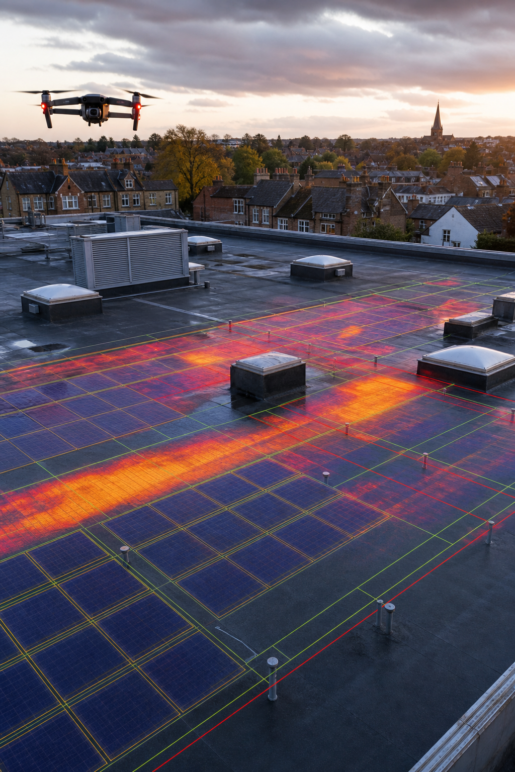
Facilities managers need regular, reliable data to keep large estates running smoothly. Drone‑based roof inspections give them a repeatable snapshot that feeds directly into maintenance schedules.
Dronevolution offers a service that ties the survey into CMMS platforms. After the flight, the data is tagged with asset IDs, so a maintenance engineer can click on a hotspot and see the exact location on the building model.
The company also provides a risk‑based scoring system , each defect gets a priority rating based on exposure, severity and cost to fix. That helps managers allocate budgets effectively.
Because the service includes a visual observer on the ground, it meets HSE safety standards and reduces the chance of a near‑miss during the flight.
For a deeper look at how this integration works, read the Dronevolution roof inspection page.
You’ll be in good hands with a partner that turns drone photos into actionable work orders.
9. High‑Resolution Orthomosaic Mapping Services
When you need a precise map of every square metre, orthomosaic stitching is the gold standard. It turns overlapping drone photos into a smooth, georeferenced image that can be measured in the browser.
SkyeBrowse provides a cloud‑based platform that accepts a standard video file, processes it in minutes and returns a 2‑D orthomosaic with centimetre‑level accuracy. The service also overlays a thermal layer if you upload a thermal video.
Because the output is a GeoTIFF, you can import it into GIS tools for flood‑risk analysis, solar‑potential modelling or asset‑verification checks.
According to Wikipedia’s UAV entry, modern photogrammetry can achieve sub‑centimetre precision under good conditions. SkyeBrowse uses that to give you a map that insurance adjusters trust.
The platform also offers a simple share link, so you can send the model to a stakeholder without creating a large file.
Bottom line: A high‑resolution orthomosaic turns raw photos into a measurement‑ready map.
10. Drone‑Based Building Defect Detection Experts
AI is now part of the drone workflow. Some providers run the captured images through machine‑learning models that automatically tag cracks, missing tiles, ponding water and corrosion.
Aerially.ai offers this capability. Their pipeline processes the photos, runs a defect‑detection algorithm and produces a colour‑coded map that highlights problem areas. The report also includes GPS coordinates for each defect, making it easy to plan targeted repairs.
The service is fast , a 10 000 sq ft roof can be analysed in under an hour, and the final PDF is delivered the same day.
Because the AI model is trained on thousands of UK roof images, it understands local roof types like EPDM and TPO. That reduces false positives and keeps the report focused on real issues.
Clients who use the AI‑enhanced report often see a 30 % reduction in on‑site inspection time, because the crew only needs to verify the flagged spots.
You’ll be in good hands when the data is verified by both a human expert and a smart algorithm.
11. End‑to‑End Asset Management Surveyors
Some firms handle the whole lifecycle , from initial drone capture to final asset‑management integration. UK Air Comms Ltd is an example. They combine aerial photography, thermal mapping and a digital‑twin platform that feeds straight into FM software.
Their pilots are CAA‑approved and they work with telecom and utility clients, so they understand high‑risk environments. The data is delivered in BIM‑compatible formats and can be overlaid with IoT sensor data for real‑time monitoring.
Because the service includes a post‑flight validation step, you get a signed certificate that the survey meets industry standards. That helps with regulatory compliance for large infrastructure projects.
When you need a partner that can turn a flat‑roof survey into a living part of your asset‑management system, an end‑to‑end provider is the way to go.
You’ll be in good hands with a team that bridges drones and digital asset platforms.
How to Choose the Right Flat Roof Survey Drone Service
First, check CAA approval and insurance limits , you need at least £5 million public‑liability cover for commercial projects. Next, confirm that the provider can deliver IEC 62446‑compliant reports if you plan a solar‑PV installation. Then, look at the sensor suite: RGB plus thermal is the baseline, LiDAR adds geometry accuracy. Finally, ask how the data will be handed over , a BIM file, a GIS‑ready GeoTIFF or a simple PDF? Choose the partner that matches your workflow.
Comparison Table: Flat Roof Survey Drone Providers
FAQ
What is a flat roof survey drone and why use it?
A flat roof survey drone is an unmanned aerial vehicle that flies over a flat‑roofed building, captures high‑resolution images and thermal data, and creates a detailed map of the roof’s condition. It lets you see hidden cracks, moisture pockets and structural issues without climbing ladders, which saves time, reduces safety risks and cuts inspection costs.
How does thermal imaging help detect roof defects?
Thermal cameras spot temperature differences that indicate water intrusion, poor insulation or failing membranes. Wet areas stay cooler after sunset, while healthy sections warm up. By reviewing a thermal heat‑map you can pinpoint leaks and plan repairs before they become costly.
Do I need CAA approval to hire a drone service?
Yes. The UK Civil Aviation Authority requires commercial operators to hold a valid Operator ID and to follow visual‑observer rules. Choosing a CAA‑approved provider ensures the flight is legal, safe and that insurance carriers will accept the data.
What does IEC 62446 compliance mean for solar PV surveys?
IEC 62446 is an international standard for testing and documenting grid‑connected photovoltaic systems. A survey that follows this standard provides verified thermal and visual data that installers and insurers can trust for warranty and risk‑assessment purposes.
How long does a typical commercial flat‑roof drone survey take?
For a medium‑size commercial roof (around 10 000 sq ft), the flight itself takes 15, 30 minutes. Data processing and report generation usually finish within 24 hours, giving you a fast turnaround that keeps projects on schedule.
Can drone surveys replace all traditional roof inspections?
Drone surveys cover visual defects, thermal anomalies and geometry. However, some tasks , like core sampling of membrane layers , still need a physical inspector. Use drones for the bulk of the inspection and follow up with targeted manual checks where the data flags a problem.
What should I look for in the final report?
A good report includes high‑resolution orthomosaics, a thermal heat‑map, a defect list with GPS coordinates, severity ratings and clear repair recommendations. It should also note compliance details (CAA, IEC 62446) and provide the data in formats you can import into BIM or FM software.
How often should I schedule flat‑roof drone surveys?
Most asset managers run a baseline survey before any major work, then repeat the inspection annually or after severe weather events. Regular surveys help track wear, catch new defects early and keep insurance premiums stable.
Conclusion
Flat‑roof drone surveys have become essential for anyone who manages commercial or public buildings. They give you a fast, safe and data‑rich view of what the naked eye can’t see. The eleven providers listed here each bring a different strength , from full IEC 62446 compliance to AI‑driven defect detection.
If you need a partner that covers every angle , compliance, insurance, detailed mapping and smooth data hand‑off , Visual Perspectives Limited is the clear choice. Their “quickly, precise, and detailed” approach means you get actionable insight without the hassle of scaffolding or manual inspections.
Take the next step: request a quote, set a baseline survey and let the data drive smarter maintenance, lower risk and better ROI for your roof assets.

