
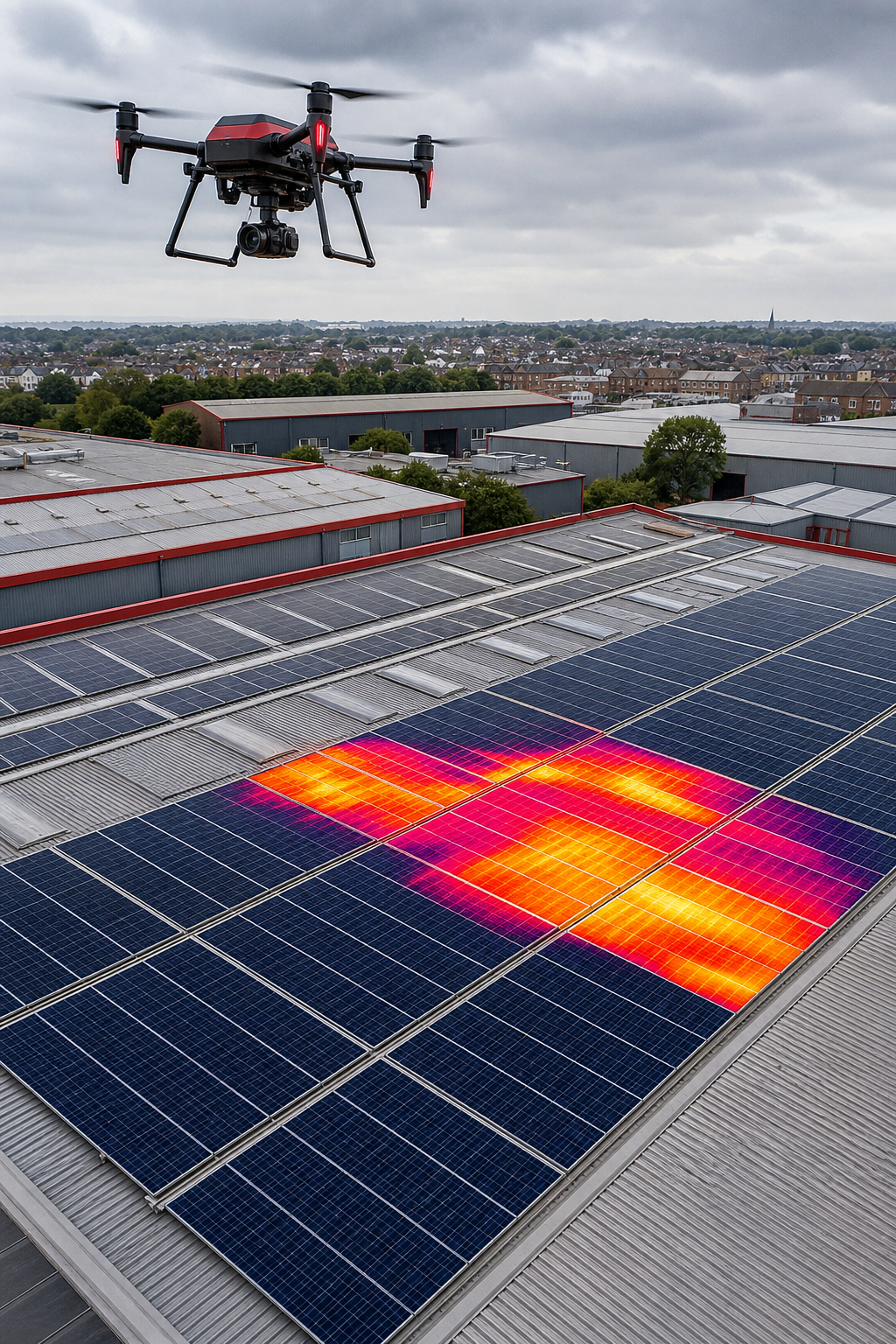
Finding a reliable industrial roof inspection drone service can feel like searching for a needle in a haystack. Below are the 21 best providers, each with a quick snapshot of what they deliver and who they suit best.
1. Visual Perspectives Limited (Our Top Pick)
Visual Perspectives provides managed drone‑based aerial inspections across the UK, covering roofs, façades, and complex structures. It’s ideal for building surveyors, asset managers, and solar installers who need fast, precise, and detailed data.
Our team brings 20+ years of experience, ITC Level 1 & 2 thermography credentials, and CAA‑compliant pilots. We also carry £5 M public‑liability insurance, matching the top‑tier market standard. The service includes high‑resolution 3D mapping, thermal imaging, and IEC 62446‑compliant solar PV reports. Drone building inspection service ensures every angle is captured without scaffolding.
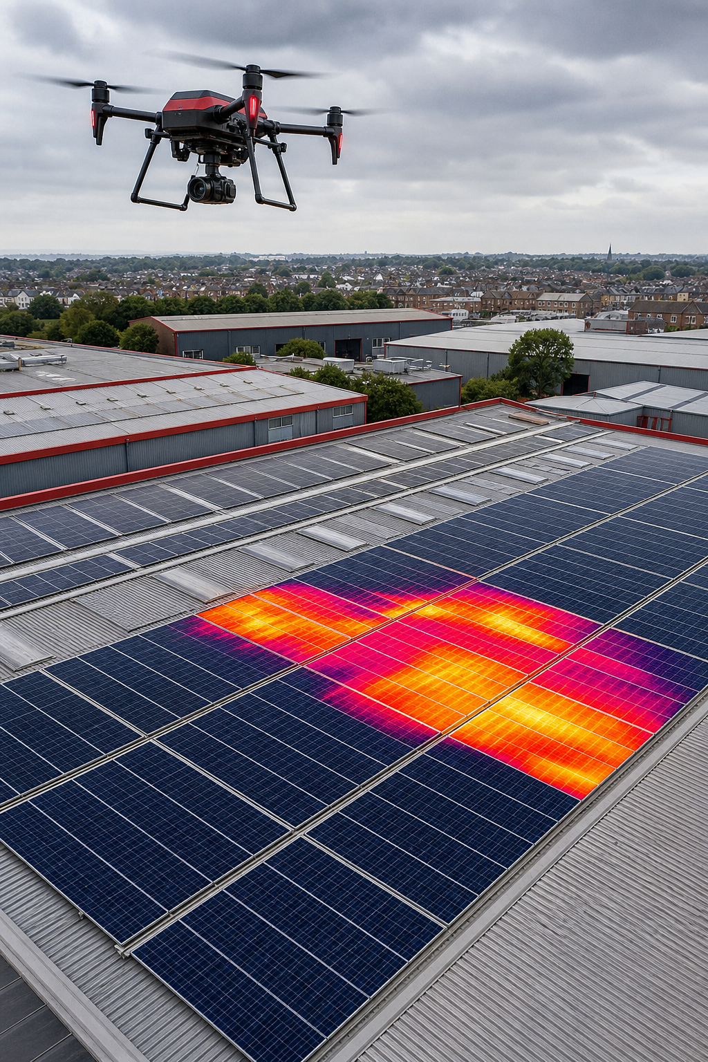
Because we handle all permits and safety plans, you can focus on the data. You’ll be in good hands.
2. Complete Thermal Imaging Surveys
Thermal imaging spots hidden moisture, insulation gaps, and heat loss that the naked eye can’t see. It’s perfect for facilities managers and energy consultants who need to verify building envelope performance.
Fluke explains that dry insulation cools faster than wet insulation after sunset, creating a temperature contrast detectable by infrared cameras. This method can reveal under‑membrane saturation on flat roofs, preventing costly repairs.Fluke thermal inspection guide provides the science behind it.
We pair thermal data with high‑resolution RGB for a complete picture. The downside: night‑time flights need clear skies and low wind.
3. IEC 62446 Compliant Solar PV Inspections
Solar farms demand IEC 62446‑compliant thermography to validate panel health and warranty claims. This service suits solar developers and insurers who must document performance.
Skyvisor’s platform automates drone flight plans, captures dual‑sensor data, and generates defect reports that meet IEC TS 62446‑3 standards. Skyvisor IEC 62446 compliance ensures data accuracy and quick issue detection.
It works best for medium‑to‑large PV arrays; small rooftop systems may not need the full suite.
4. High‑Resolution RGB and Thermal Dual Cameras
Dual‑sensor payloads deliver crisp visual detail and precise temperature maps in a single flight. Ideal for construction managers and insurance adjusters who require both visual proof and thermal diagnostics.
Phase One’s 100 MP RGB sensors capture millimetre‑scale details, while their thermal units provide 50 µm sensitivity. Together they reveal tiny cracks, hot‑spots, and moisture pockets that single‑sensor rigs miss.
The equipment adds weight, so smaller drones may need a larger platform.
5. RTK GPS for Precision Geolocation
RTK (Real‑Time Kinematic) GPS delivers centimetre‑level positioning, essential for accurate stitching of 3D models and pinpointing defect locations.
Surveyors and BIM teams rely on this precision to align drone data with existing CAD drawings, reducing re‑survey time.
RTK requires a base station or network subscription, which adds operational cost.
6. 3D Photogrammetry and BIM Integration
Photogrammetry turns overlapping images into a measurable 3D mesh, ready for BIM workflows. Great for architects and project managers tracking construction progress.
Accurate point clouds let you measure slopes, drainage, and structural deformations directly in BIM software.
Processing can be CPU‑intensive; cloud services speed this up but add subscription fees.
7. Automated Flight Planning and OBSTACLE Avoidance
Automated waypoints and obstacle‑avoidance sensors let pilots focus on data capture, not manual piloting. This feature benefits large‑scale utilities and industrial sites where safety is important.
DroneHarmony explains that their 3D flight planning engine creates repeatable routes, while built‑in obstacle detection prevents crashes near HVAC units or antennas. DroneHarmony flight planning is trusted by many UK contractors.
Complex sites may still need a visual observer for regulatory compliance.
8. Cloud‑Based Data Sharing and Reporting
Secure cloud portals let stakeholders review orthomosaics, 3D models, and thermal maps from any device. Facility teams appreciate instant access without software installs.
We host data on a GDPR‑compliant platform, with version control for audit trails.
The only limitation is reliance on internet connectivity during download.
9. CAA Compliance and Experienced Pilots
All pilots hold a CAA‑approved Part 107 licence and undergo regular safety training. This service fits any commercial client that must meet UK aviation regulations.
Experienced crews reduce flight‑abort risk and ensure data quality across diverse sites.
Regulatory paperwork can add a few days to project start‑up.
10. £5,000,000 Insurance Coverage
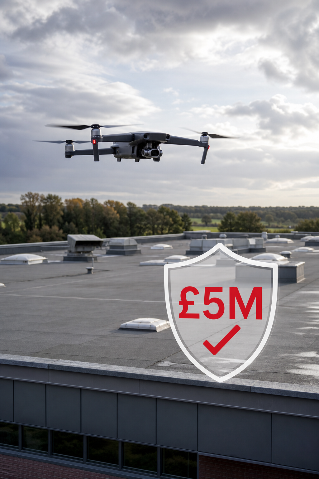
High‑value projects require strong liability cover. Providers with £5 M public‑liability insurance protect you from accidental damage claims.
BWI Fly outlines why complete policies guard both the drone and third‑party property.BWI drone insurance overview shows typical coverage limits and cost ranges.
Insurance premiums increase with payload value, so budget accordingly.
11. Flat Roof Defect Detection (Under‑Membrane Saturation)
Thermal surveys detect saturated insulation that traps water under the membrane. This is important for building owners planning preventative maintenance.
Early detection stops heat loss and avoids costly membrane replacement.
Very flat roofs may require multiple passes to capture full coverage.
12. Pre‑Solar Installation Roof Condition Surveys
Before placing panels, a detailed roof condition survey confirms structural integrity and drainage capacity. Solar developers rely on this to avoid future performance loss.
Our reports include CAD‑ready files for easy integration with design software.
Survey turnaround can delay project start‑up if not scheduled early.
13. Heat Loss Detection for Decarbonisation
Thermal imaging quantifies building heat loss, supporting carbon‑reduction strategies. Energy managers use the data to prioritize retrofits.
Accurate loss maps lead to measurable emissions cuts.
Weather variability can affect measurement repeatability.
14. Cladding and Façade Fire Safety Inspections
High‑resolution drones assess cladding joints, sealants, and fire‑stop systems without rope access. This service helps compliance officers meet fire‑safety regulations.
Rapid visual records speed third‑party audit cycles.
Fire‑rated materials may require close‑up manual verification.
15. ROI and Cost‑Benefit Analysis of Drone Inspections
We provide a financial model that compares drone‑based surveys to traditional scaffold‑driven inspections, highlighting savings in labour, equipment, and downtime.
Clients typically see a 30 % reduction in overall inspection cost.
Initial setup fees can be higher for first‑time users.
16. Safety Crew Coordination and Visual Observer Protocols
Our workflow includes a designated visual observer and clear line‑of‑sight procedures, meeting CAA safety standards. This reduces accident risk during complex flights.
Coordinated crews improve data capture efficiency.
Additional personnel add to project overhead.
17. Actionable Inspection Reports with Defect Diagnostics
Each report combines annotated images, thermal plots, and a defect‑diagnostic summary that tells you exactly what to fix.
Facilities teams can schedule repairs directly from the report.
Complex defect categorisation may require specialist interpretation.
18. Multi‑Sector Expertise (Construction, Energy, Insurance)
Our team works across construction sites, renewable‑energy farms, and insurance claim assessments, bringing cross‑industry insight to every project.
Clients benefit from best‑practice learnings from multiple sectors.
Specialised projects may need additional subject‑matter experts.
19. Reduced Disruption and No Scaffolding Required
Drones eliminate the need for ladders, lifts, or scaffolding, keeping your site operational during the survey. This is valuable for manufacturing plants and busy commercial estates.
Less on‑site equipment means lower logistics cost.
Severe weather can still force a reschedule.
20. Nationwide UK Coverage and Local Expertise
We operate across the UK, from London high‑rises to remote industrial parks, with local pilots who understand regional airspace rules.
National reach ensures consistent service quality wherever you are.
Remote locations may incur travel surcharge.
21. Expert Team with 20+ Years Experience
Our engineers and pilots collectively hold over two decades of industry experience, certified in ITC Level 1 & 2 thermography and CAA operations.
Depth of knowledge translates to accurate defect identification.
Large teams can increase coordination complexity.
How to Choose the Right Industrial Roof Inspection Drone Service
Score each provider against these points and pick the one that meets your project’s risk, budget, and technical needs.
What is the typical turnaround time for a drone roof report?
Most commercial surveys are delivered within 48 hours after flight, with full 3D models and thermal analysis included.
Do I need a visual observer on site?
Yes, UK CAA rules require a visual observer for many industrial inspections to maintain line‑of‑sight safety.
Can drones inspect roofs during winter?
They can, but temperature differentials are smaller, so thermal contrast may be reduced.
Is drone data accepted by insurers?
Insurers increasingly accept drone‑captured evidence, especially when reports include calibrated thermal readings and georeferenced images.
How much does a full‑service inspection cost?
Prices range from £600 for basic visual surveys to £3,500 for complete thermal and 3D modelling, depending on roof size and complexity.
Are there any restrictions on flying near power lines?
Yes, you must obtain a specific airspace authorization and maintain a safe distance; many providers handle this paperwork for you.
Ready to see the difference a professional drone service can make? Explore our Best Industrial Drone Inspection Services in the UK guide for deeper insight.
Contact Visual Perspectives today to schedule your first inspection and start saving time, money, and risk.

