
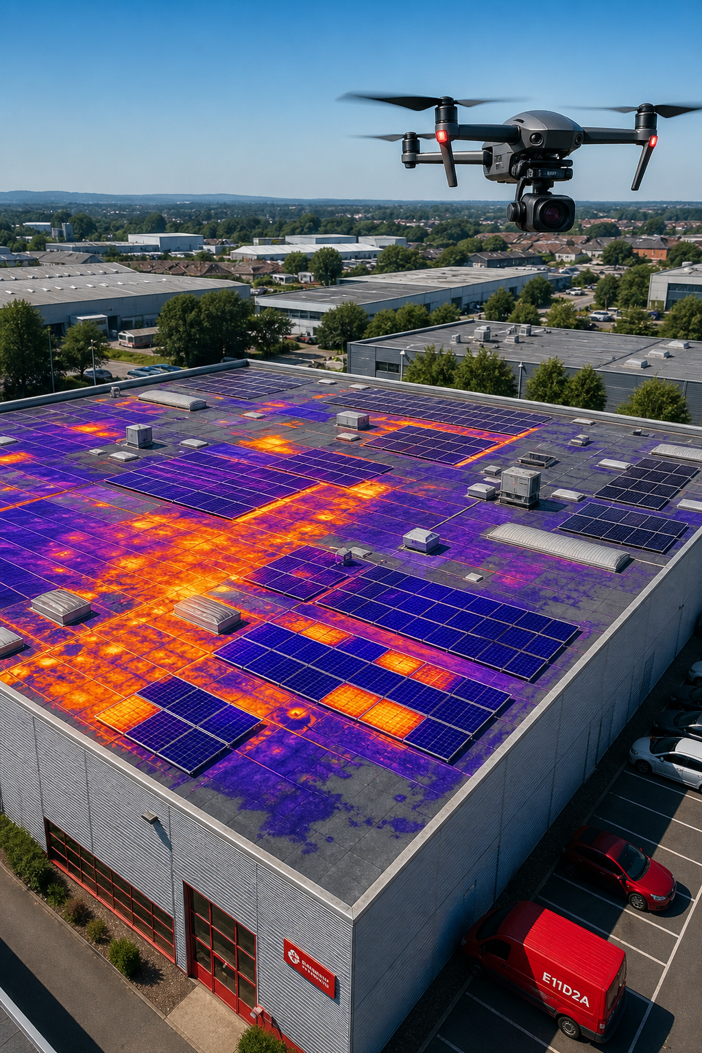
Roof work can be risky, noisy, and expensive. Imagine detecting a hidden leak or a malfunctioning solar panel without ever stepping onto the roof. That’s what drone thermography provides for commercial properties, as detailed in our drone roof survey guide. In this guide we’ll explore what the technology is, how it operates, where it excels, why facilities managers value it, and which regulations apply. By the end you’ll understand why Visual Perspectives is the trusted partner for fast, precise, and detailed inspections.
What Is Drone Thermography?
Drone thermography blends two ideas: an unmanned aerial vehicle (UAV) that can fly over a roof, and a thermal camera that records infrared radiation. The camera translates heat into a colour‑coded image that shows temperature differences you can’t see with your eyes. According to thermography reference every object emits infrared energy proportional to its temperature, and a radiometric sensor measures that energy.
When a drone carries that sensor over a commercial roof, it creates a map of hot and cold spots. Hot spots often mean a defect , a broken solar cell, a moisture‑filled insulation cavity, or an overloaded junction box. Cold spots can point to shading or a disconnected panel. The result is a visual report that tells you exactly where to look.
Visual Perspectives offers this service across the United Kingdom. Our pilots hold a CAA PfCO, our thermographers are ITC Level 1 & 2 certified, and we back every job with £5 million liability insurance. That mix of skill and safety is rare , only one other firm in a recent market survey listed the same credentials.
Because the data is captured from the air, you avoid scaffolding, ladders, or roof‑walking. That means less disruption to occupants, lower safety risk, and a faster turnaround. You’ll be in good hands.
How Drone Thermography Works: Sensors and Data Capture
The heart of the system is the thermal sensor, technically a micro‑bolometer. Modern micro‑bolometers operate at ambient temperature, eliminating the need for cryogenic cooling, which keeps the payload light and the cost reasonable.
When the sensor observes a surface, it records the amount of infrared energy received by each pixel. That energy is then converted into a temperature value. Software applies a colour palette so hotter areas appear red and cooler areas appear blue. Operators can switch palettes to highlight subtle differences.
Our drones mount the sensor on a gimbal. The gimbal keeps the camera level even as the aircraft tilts, allowing a 360‑degree sweep. Flight‑planning software defines a grid that guarantees at least 80 % forward overlap and 70 % side overlap. Overlap is vital because it enables us to stitch the images into an orthomosaic and build a 3‑D model.
During the flight we record GPS coordinates for every frame. After landing, we feed the raw files into photogrammetry software. The software aligns the images, creates a textured 3‑D model, and overlays the thermal layer. The final product includes an interactive map, a PDF report, and a set of raw data files for future comparison.
Our team follows the Drone Thermal Imaging for Commercial Buildings guide to standardise every step, from safety checks to data processing. The process is repeatable, which means you receive consistent results across multiple roofs and over time.
Because the sensor captures temperature at a rate of 25 Hz, we can even film moving equipment to spot overheating in real time. The data can be exported to CSV for integration with asset‑management software.
Key Applications in Commercial Roof and PV Inspections
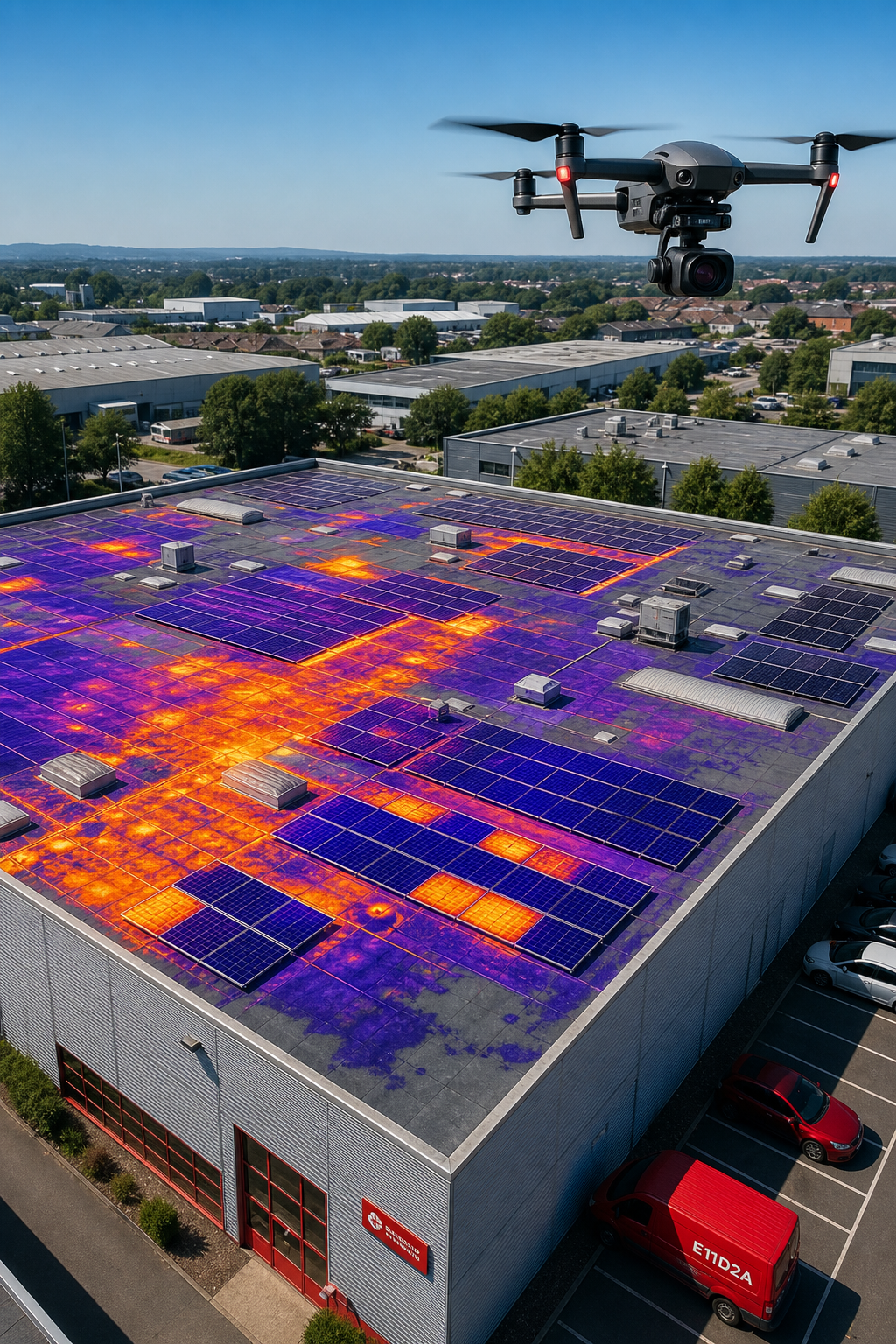
Thermal imaging shines in three main commercial scenarios. Visual Perspectives Limited delivers these services across the UK.
- Detecting moisture intrusion in flat or low‑slope roofs. Wet insulation holds heat longer, so it appears warmer in the evening scan.
- Finding defective solar PV modules. Hot spots indicate cell failure, bypass‑diode issues, or potential induced degradation (PID).
- Spotting electrical hot spots in roof‑mounted equipment such as HVAC units, UPS racks, or lighting arrays.
Let’s look at a real‑world example. A large retail centre installed a 150 kW rooftop PV array. Our drone flew an IEC 62446‑compliant survey and identified ten panels with hotspots above 45 °C while the rest of the array ran at 30 °C. Those panels were replaced, restoring 4 % of the system’s output, a clear cost‑saving.
Another case involved a hospital with a flat roof that showed signs of water pooling after a heavy rain. The thermal map highlighted a 3 m × 2 m warm patch that matched a failed membrane seam. The facility manager repaired the seam before mold developed, avoiding an estimated £25 k remediation cost.
Thermal data also supports insurance claims. Insurers accept thermographic reports as evidence of pre‑existing conditions, which speeds claim settlement.
All of these applications follow the IEC 62446 standard for solar inspections. The standard requires clear sky, at least 600 W/m² solar irradiance, and a minimum image resolution of 5 × 5 pixels are formatted to meet those rules, so you can submit them for warranty or ESG documentation without extra work.
Benefits for Facilities Managers and Asset Owners
Facilities managers juggle safety, cost, and compliance. Drone thermography helps on all three fronts.
Reduce risk. By keeping crews off the roof, you eliminate fall hazards. The CAA‑approved flight plan ensures legal compliance, and our £5 M insurance covers any unexpected incident.
Cut costs. A traditional roof walk can take a day, need scaffolding, and involve multiple trades. A drone survey usually finishes in under an hour and delivers a full report in 48 hours. According to industry research, drone surveys cut field time by 60‑80 % while matching traditional accuracy.
Speed up decision‑making. The interactive map lets you zoom to a hot spot, view the RGB photo underneath, and read a risk rating. You can prioritise repairs based on severity, which keeps budgets in check.
Our clients often use the data for decarbonisation reporting. By identifying heat loss through roof defects, you can plan insulation upgrades that lower heating demand. Over a year, that translates into measurable carbon‑reduction metrics for ESG reporting.
Because we deliver data in GIS‑ready formats, you can feed the findings directly into your asset‑management system. That means the same data that shows a faulty panel today can be compared to next year’s survey to track performance trends.
In practice, a university campus used our service to audit three buildings. The thermal scans revealed hidden moisture in two roofs, prompting targeted repairs that saved £12 k in emergency fixes. The campus also used the PV defect data to claim warranty coverage for 15 panels, recovering £3 k.
You’ll be in good hands with Visual Perspectives Limited, we combine speed, safety, and data quality so you can keep your assets running smoothly.
Compliance, Standards, and Reporting (IEC 62446 & UK Regulations)
Regulatory compliance is a major driver for commercial roof surveys. In the UK, the Civil Aviation Authority (CAA) governs drone operations. Operators need a Flyer ID for drones over 100 g and an Operator ID for any commercial use. The CAA also defines three Open‑Category sub‑categories that dictate how close you can fly to people and buildings. You can read the full guidance on CAA drone regulations.
For solar PV inspections, the international IEC 62446 standard sets the bar. It spells out the environmental conditions (clear sky, specific irradiance), the imaging resolution, and the reporting format. A compliant report includes:
- Geotagged thermal images.
- Temperature values for each identified anomaly.
- A risk rating and recommended remedial action.
- Signature of a Level 3 Certified Thermographer.
Visual Perspectives’ reports match those requirements word for word. Visual Perspectives aligns with UK building regulations that demand regular roof condition surveys for commercial properties over a certain size. The data we provide satisfies both the safety inspection and the energy‑efficiency audit components of those rules.
When you need to prove compliance to insurers or warranty providers, the IEC‑aligned format saves you time. No extra testing, no re‑work , just a ready‑to‑submit document.
You’ll be in good hands knowing the inspection meets every relevant rule.
FAQ
What equipment does a drone thermography survey use?
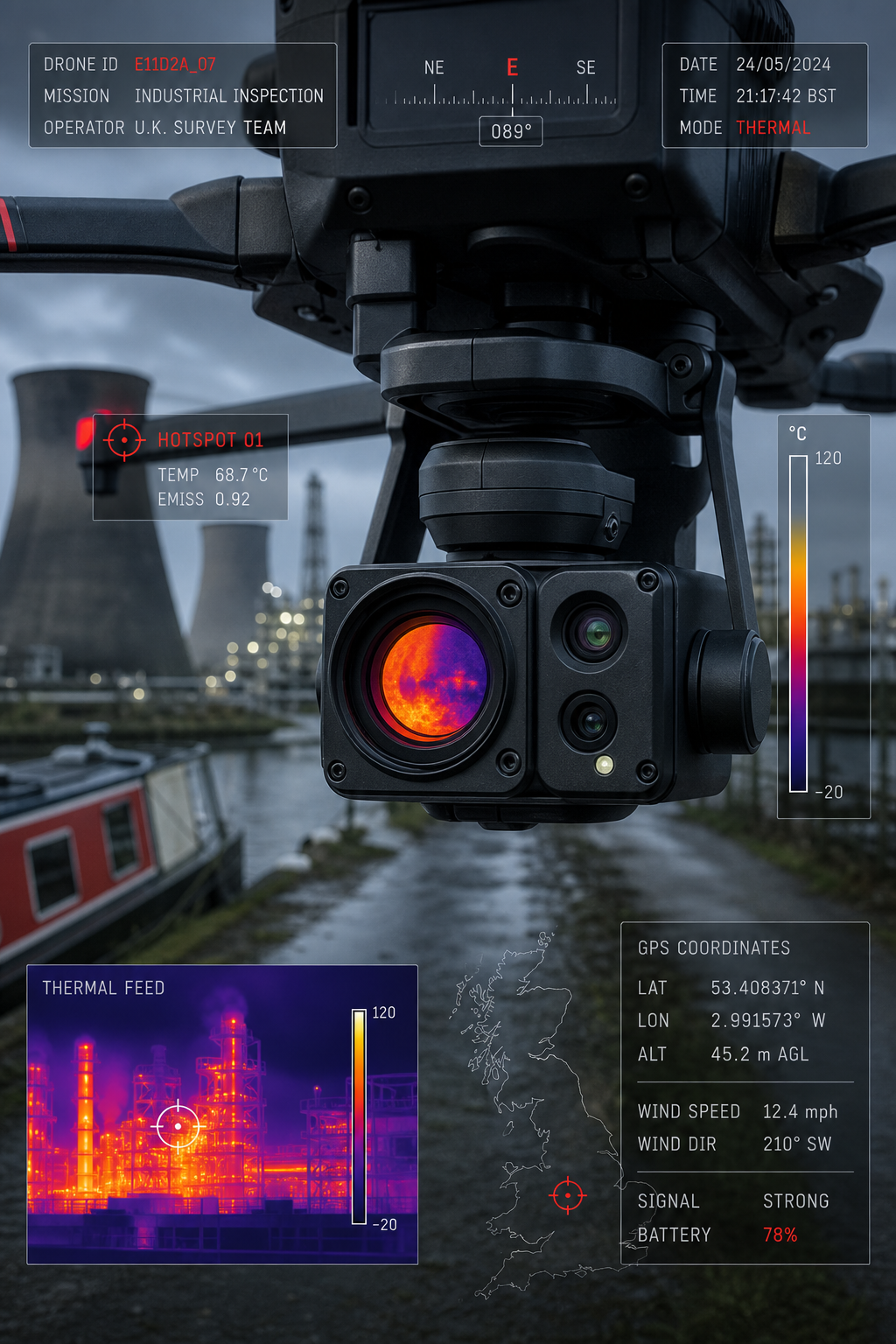
We fly a professional‑grade drone platform fitted with a radiometric thermal sensor (640 × 480 pixels) and a high‑resolution RGB camera. The thermal sensor records temperature at 25 Hz, while the RGB camera captures visual detail. Both sensors are mounted on a three‑axis gimbal that keeps the lenses level during flight. The data is geotagged and processed into an orthomosaic and a 3‑D model.
How often should a commercial roof be surveyed?
Best practice is to conduct a thermal survey at least once a year, ideally after the main heating season when temperature contrasts are strongest. If you have solar PV arrays, schedule a survey after the summer months to capture peak irradiance conditions required by IEC 62446.
Can drone thermography replace all manual inspections?
It replaces the visual walk‑down for most defect detection, but you may still need a targeted physical inspection for complex issues like structural cracks or to verify a suspected leak. The thermal data tells you where to look, saving time and reducing the amount of hands‑on work.
Is the data secure and confidential?
All images and reports are stored on encrypted servers that comply with GDPR. Access is limited to the client’s project team and our certified analysts. We never share data with third parties without explicit permission.
What qualifications do your pilots and thermographers hold?
Our pilots hold a CAA Permission for Commercial Operations (PfCO) and a UK Operator ID. The thermographers are ITC Level 1 & 2 certified and follow ISO 18436‑7 and IEC 62446 standards. Together this ensures safe flight and accurate thermal analysis.
How are the reports delivered?
We provide a web‑based portal where you can view the interactive map, download the PDF report, and access raw data files. The PDF includes a summary, annotated images, temperature tables, and a recommended action plan. You can also export the GIS layers for integration with your asset‑management system.
Conclusion
Drone thermography gives commercial roof owners a fast, safe, and data‑rich way to spot hidden defects. It reduces the need for scaffolding, shortens inspection time, and delivers reports that meet IEC 62446 and UK CAA regulations. The technology helps facilities managers lower risk, cut repair costs, and meet decarbonisation targets.
At Visual Perspectives we bring 20 years of experience, certified thermography expertise, and full insurance coverage to every project. Our “quickly, precise, and detailed” surveys let you see what the naked eye can’t see, and our actionable reports keep your assets running smoothly.
If you’re ready to move from guesswork to guaranteed data, get in touch with us to schedule a survey. You’ll be in good hands.

