
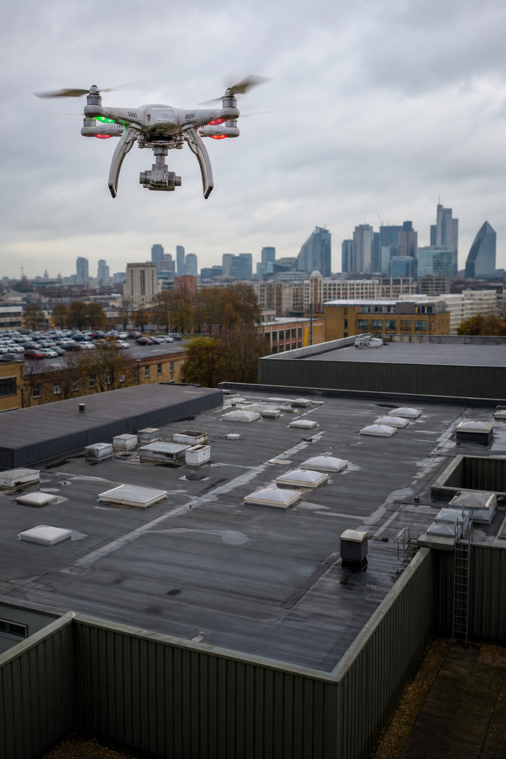
When a flat roof leaks or a solar array underperforms, the cost adds up fast. You need answers , fast, accurate, and without scaffolding. That’s where a drone survey company like Visual Perspectives comes in. We use drones equipped with thermal cameras and high-resolution sensors to inspect commercial buildings safely from the ground. In this guide, we’ll walk you through six essential services every property manager, surveyor, and solar installer should know. From roof defect detection to IEC 62446 compliant thermography, you’ll learn how drone surveys save money, reduce risk, and protect long‑term investments. Let’s get started.
1. Drone Roof Inspections , Spot Defects Before They Cost Thousands
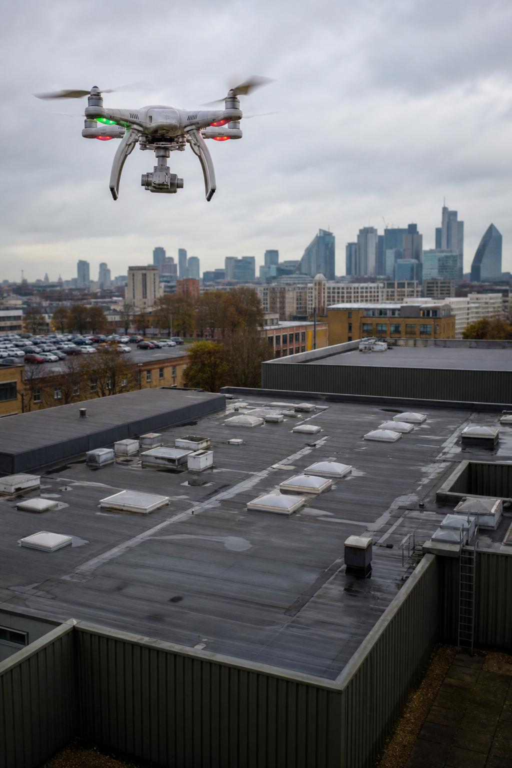
Commercial roofs are tough to access. Ladders, scaffolding, or cherry pickers are expensive and risky. A drone survey company like Visual Perspectives changes that. We fly a drone over your roof, capturing images and thermal data in minutes. No one needs to climb. No safety usees. No disruption to tenants or operations.
What do we find? Blistering, ponding water, failed flashings, and hidden leaks. Traditional walk‑throughs miss many of these defects. Drones see the whole roof from above. We spot early signs of decay before they turn into costly repairs. According to Skyebrowse’s drone roof inspection cost guide, a drone survey can cut inspection time by up to 75% compared to manual methods. That means fewer hours on site and faster reports.
But it’s not just about speed. It’s about detail. Our high‑resolution cameras capture every square inch. We create orthomosaic maps that show the entire roof surface. You get a permanent record you can compare year after year. For flat roofs, this is gold. Ponding water, membrane tears, and deterioration are easy to spot. We even measure the area of defects so you can budget repairs accurately.
Imagine a school with a 10,000 sq ft flat roof. A manual inspection takes two days and needs scaffolding. Cost: £3,000+. A drone survey takes two hours. Cost: £800. You get the same , often better , data. The Drone Roof Survey guide from Visual Perspectives explains how we do it.
“The best time to inspect your roof is before the leak shows inside.”
We’ve seen roofs where a small blister went unnoticed for years. By the time water entered the building, the insulation was ruined and the deck needed replacement. A drone survey catches these early. Our pilots are trained in thermography and roof construction. You’re not just getting pictures , you’re getting a diagnosis.
What the Report Includes
- High‑resolution RGB images of the entire roof
- Thermal anomalies indicating moisture or heat loss
- Measured areas of defects (e.g., ponding, blistering)
- Priority ratings: urgent, soon, monitor
- CAD‑compatible orthomosaic for integration with your asset management system
Bottom line: Drone roof inspections deliver faster, safer, and more detailed assessments than traditional methods, preventing costly emergency repairs.
2. Solar PV Thermography , IEC 62446 Compliant Thermal Surveys
Solar panels are a big investment. A 500 kW rooftop array costs £500,000 or more. You expect it to generate power for 25 years. But defects happen: micro‑cracks, hot spots, potential induced degradation (PID). They’re invisible to the naked eye. A drone survey company with thermal imaging expertise can find them fast.
We use radiometric thermal cameras to scan every panel. Hot spots show up as bright areas , they indicate cells that are overheating. Under IEC 62446‑3, a temperature difference of more than 30°C above ambient is safety‑critical. Our reports flag these immediately. According to Datature’s article on solar defect detection, drone‑based thermal inspection can cover 100+ MW per day at a cost roughly 45% lower than manual methods.
Why is this important for commercial buildings? Because many solar installations are on flat roofs. Before installing panels, you should survey the roof with a drone to find existing defects. Then after installation, a thermal scan checks for manufacturing faults or installation errors. Annual scans protect your warranty and insurance requirements. Our reports are IEC 62446 compliant, accepted by insurers and warranty providers.
| Defect Type | Visible in RGB? | Visible in Thermal? | Impact |
|---|---|---|---|
| Micro‑cracks | No | Yes (hot spots) | Reduced output, accelerated degradation |
| PID | No | Yes (string‑level warming) | Up to 30% power loss |
| Diode failure | No | Yes (characteristic pattern) | Sub‑string stops conducting |
| Soiling | Yes | Indirect (uneven heating) | 1–5% output loss per month |
We also provide pre‑installation roof surveys to identify areas that need repair before panels go on. This avoids costly rework later. Read more in our Commercial Solar Panel Survey guide.
Bottom line: IEC 62446 compliant thermal surveys from a specialist drone survey company protect your solar investment and ensure maximum energy generation over the system’s lifetime.
3. Thermal Imaging for Building Diagnostics , Detect Heat Loss & Moisture
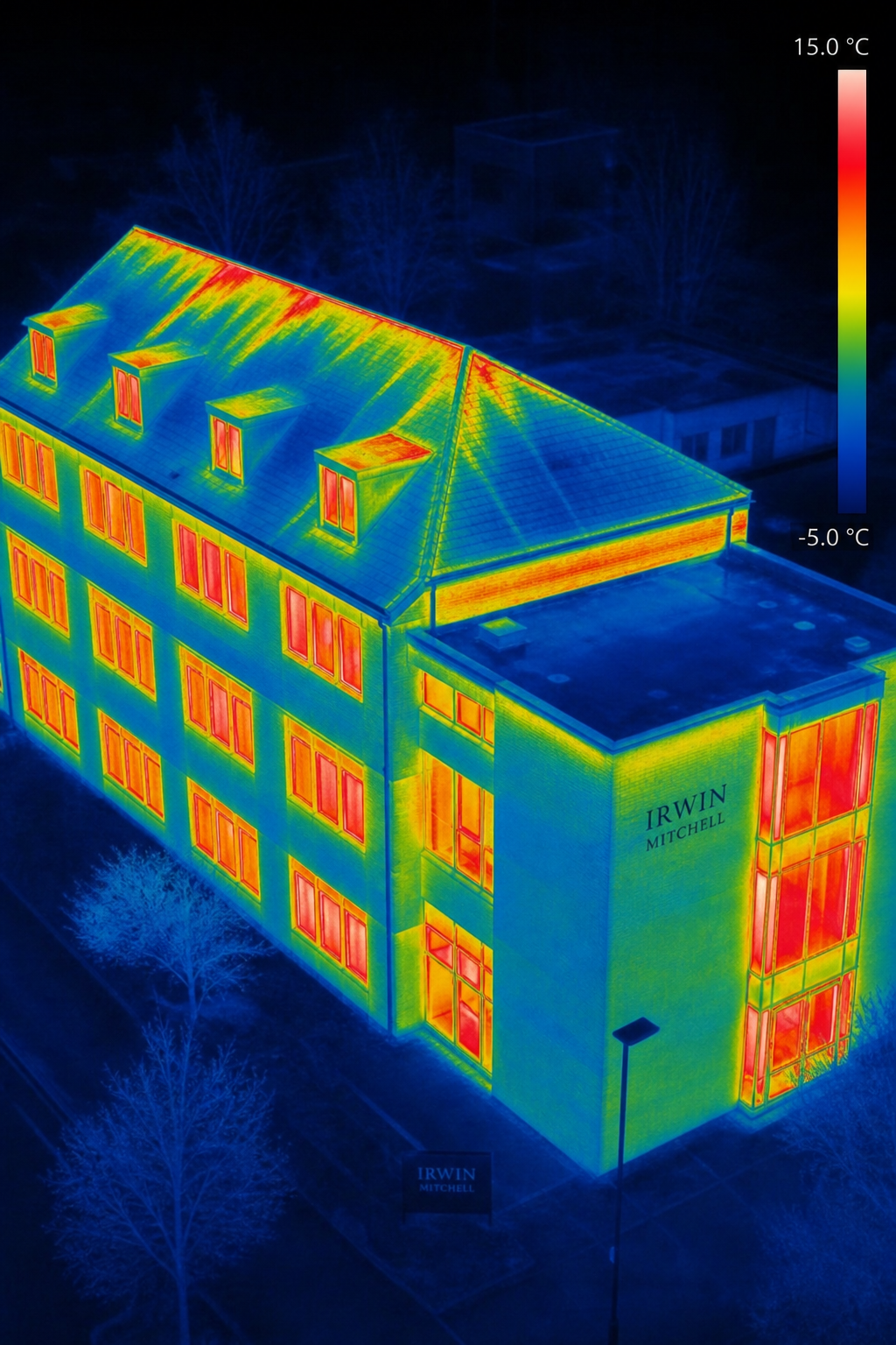
Energy efficiency is a top priority for commercial buildings. Rising energy costs and net‑zero targets mean every leak matters. A drone survey company equipped with thermal cameras can map heat loss across your entire building envelope in a single flight. No cherry pickers, no ladders, no disruption.
We fly at dawn or dusk when temperature differences are greatest. The thermal camera shows cold bridging, missing insulation, and air leaks. We also detect moisture trapped inside walls or flat roofs , a common cause of mould and structural damage. According to the Wikipedia page on thermography, this technique is widely used in building diagnostics because it is non‑invasive and rapid.
Our clients include housing associations, universities, and NHS Trusts. They use our data to prioritise retrofit projects, apply for funding, and verify works. For example, a university with a 1960s concrete building used our thermal survey to pinpoint cold spots. They upgraded insulation in those areas, cutting heating costs by 18%.
Thermal imaging also helps with flat roof moisture detection. Wet insulation holds heat differently. Our cameras show exactly where the insulation is saturated. That allows targeted repairs instead of replacing the entire roof. The Drone Thermal Imaging for Commercial Buildings guide covers this in detail.
“Thermal imaging lets you see what the naked eye can’t , moisture, heat loss, and electrical faults.”
We are certified at ITC Level 1 and Level 2 in Thermography. Our reports are detailed and actionable. We don’t just hand over images; we explain what each anomaly means and recommend next steps.
Bottom line: Drone‑based thermal imaging surveys detect heat loss, moisture, and insulation defects quickly, supporting energy efficiency upgrades and preventative maintenance.
4. Aerial Mapping and 3D Surveying , High-Resolution Digital Twins
A picture is worth a thousand words. A 3D digital twin is worth a million. A drone survey company can capture every angle of your building and create an accurate 3D model. This is invaluable for planning, maintenance, and compliance.
We use photogrammetry , taking hundreds of overlapping images , to create point clouds and mesh models. The accuracy is survey‑grade, often within 1, 2 cm. According to Wingtra’s comparison of LiDAR vs photogrammetry, drone photogrammetry is cost‑effective for most building surveys and delivers high‑resolution texture and geometry.
What can you do with a digital twin?
- Measure distances, areas, and volumes without going on site
- Overlay BIM (Building Information Modelling) data
- Plan solar panel layouts or HVAC replacements
- Monitor structural changes over time
- Share with remote teams for collaborative decision‑making
We deliver models in formats like OBJ, DXF, or PDF. They can be imported into CAD or GIS software. For large estates, we create orthomosaic maps that tile together perfectly. This gives you a bird’s‑eye view of your entire portfolio.
For example, a council with 50 public buildings asked us to survey all roofs. We created a single orthomosaic covering 200,000 sq m. They used it to prioritise roof repairs and budget for the next five years. The cost was a fraction of traditional surveying.
Bottom line: Drone‑based 3D mapping provides highly accurate digital twins that improve asset management, planning, and communication across your property portfolio.
5. Façade and Hard-to-Access Area Inspections , Safe, No Scaffolding Needed
Inspect a high‑rise façade the old way? Scaffolding, abseiling, or a cherry picker. It’s slow, expensive, and risky. A drone survey company can inspect every floor, every window, every panel from the ground. No access equipment. No traffic closures.
We fly close to the building, capturing detailed images of cladding, sealants, brickwork, and windows. For historic buildings or those with complex geometry, this is a game changer. After the Grenfell tragedy, cladding inspections became essential. Drones are the only practical way to survey tall buildings quickly.
Our pilots are CAA‑compliant and insured up to £5 million. We follow strict safety protocols, especially when flying near people or traffic. According to the CAA’s official drone guidance, commercial operators must hold appropriate permissions and insurance.
We also inspect hard‑to‑access areas like chimneys, roof edges, and gutters. These are spots where defects often start but are ignored because they’re too difficult to reach. A drone checks them in minutes.
One client , a large hotel chain , needed annual façade inspections across 20 properties. Previously they used abseilers costing £5,000 per inspection. We now do all 20 with drones for £1,500 each. The data is better, and no one is at risk.
“We don’t put people at risk. The drone goes where it’s dangerous for a person.”
Bottom line: Drone façade inspections eliminate the need for scaffolding and access equipment, providing safe, fast, and detailed surveys of even the tallest buildings.
6. LiDAR and High-Resolution Photogrammetry , Survey-Grade Accuracy
When millimetre accuracy matters, a standard drone survey might not be enough. That’s when you need a drone survey company that offers LiDAR or advanced photogrammetry. We have both capabilities.
LiDAR uses laser pulses to measure distances. It penetrates vegetation and works in low light. It’s ideal for terrain mapping, stockpile volumes, and complex structures. Photogrammetry, on the other hand, uses images. It produces realistic textures but relies on good light and clear surfaces. According to Cintoo’s guide to drone photogrammetry, combining both methods gives the best results: geometric accuracy from LiDAR and visual detail from photogrammetry.
We use RTK drones for centimetre‑level accuracy without ground control points (though we often place them for extra precision). Our outputs include LAS point clouds, mesh models, and contour lines. Surveyors and engineers love this data because it’s ready to use in their workflows.
| Method | Best For | Accuracy | Data Size |
|---|---|---|---|
| Photogrammetry (RGB) | Building facades, roofs, orthomosaics | 1–3 cm | Medium |
| Thermal Photogrammetry | Heat loss mapping, moisture detection | 3–5 cm | Medium |
| LiDAR | Terrain, vegetation penetration, stockpiles | 1–5 cm | Large |
For example, a solar farm developer needed accurate terrain models to design drainage. We flew both LiDAR and photogrammetry. The LiDAR gave them the bare earth surface; the photogrammetry added colour for planning presentations. They saved weeks compared to ground‑based survey.
We also use this for flat roof surveys where precise slope measurements are needed. If a roof has poor drainage, water pools and damages the membrane. Our elevation models show exactly where to add falls.
Bottom line: LiDAR and advanced photogrammetry deliver millimetre‑accurate data for critical projects, complementing standard drone surveys when precision is important.
Frequently Asked Questions
What is a drone survey company?
A drone survey company uses unmanned aerial vehicles (UAVs) equipped with cameras, sensors, and thermal imagers to collect data on buildings and land. They provide services like roof inspections, thermal imaging, and 3D mapping for commercial properties. The data helps facility managers, surveyors, and engineers make informed decisions about maintenance, repairs, and energy efficiency.
How much does a drone roof inspection cost?
Costs vary depending on the size and complexity of the roof. For a typical commercial building (10,000 sq ft), a drone roof inspection costs between £500 and £1,500. This includes the aerial survey, data processing, and a detailed report. For larger portfolios, volume discounts apply. Contact Visual Perspectives for a custom quote.
What is IEC 62446 and why is it important for solar surveys?
IEC 62446 is an international standard for testing, documentation, and maintenance of grid‑connected photovoltaic systems. Part 3 covers thermal imaging inspections. Compliance ensures that the survey is carried out under correct conditions (irradiance, temperature) and that anomalies are reported consistently. Insurers and warranty providers often require IEC 62446 reports.
Can drones inspect flat roofs with standing water?
Yes, drones can safely fly over wet roofs. In fact, thermal imaging works best when there is moisture, because temperature differences are more pronounced. However, the drone pilot must assess weather conditions. We do not fly in heavy rain or high winds. Our thermal cameras can detect moisture even under the surface of the roof membrane.
How often should I schedule a drone survey for my commercial building?
We recommend an annual drone survey for most commercial buildings. For roofs with known issues or solar arrays with performance guarantees, biannual surveys are better. After extreme weather events (storms, heavy snow), an additional survey is wise. Regular surveys allow you to spot trends and budget for repairs before they become emergencies.
Are drone operators in the UK licensed?
Yes, commercial drone operators must hold a Permission for Commercial Operations (PfCO) from the CAA, or be covered under an Operational Authorisation. Visual Perspectives is fully CAA compliant with £5 million insurance. Our pilots also hold ITC certifications in thermography.
What deliverables do I get from a drone survey?
Depending on the service, you receive a range of deliverables: high‑resolution photos, thermal images, orthomosaic maps, 3D models (OBJ, LAS), and a written report with defect annotations and measurements. All reports are actionable and tailored to your needs. We can also provide CAD integration or GIS layers.
Can drone surveys detect hidden structural issues?
Drone surveys excel at detecting surface defects and thermal anomalies. They can reveal signs of structural issues like cracks, heaving, or moisture ingress. However, they do not replace intrusive testing. For example, a thermal image may show cold bridging, but you may need a core sample to confirm insulation condition. We always recommend a multi‑layered approach.
Conclusion
Commercial buildings are complex assets. Managing them requires accurate, timely data. A professional drone survey company like Visual Perspectives delivers that data safely and cost‑effectively. From roof inspections to solar thermography, from thermal building diagnostics to 3D digital twins, we help you see what you’re missing.
We’ve been in the business for over 20 years. Our team holds ITC thermography certifications, CAA compliance, and £5 million insurance. We work with building surveyors, asset managers, solar installers, and insurers across the UK. Our reports are detailed, actionable, and compliant with standards like IEC 62446.
Don’t wait for a leak or a failed inverter to tell you something’s wrong. Schedule a drone survey today. Get in touch with Visual Perspectives for a free consultation and quote. We’ll help you protect your building and your bottom line.

