
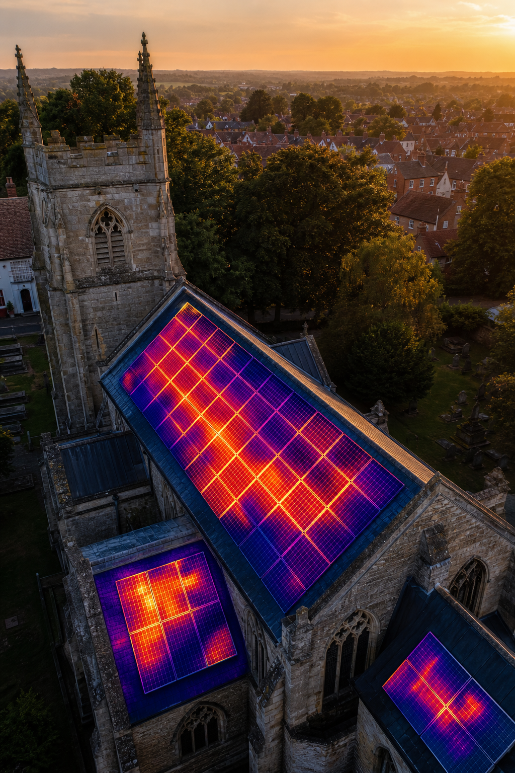
Church roofs are big, high, and often hard to reach. A missed leak can damage priceless stained glass and cost thousands to fix. The good news is that a drone can fly over the roof, snap crisp images, and spot trouble before it spreads. In this article we break down the top providers you can call on for a fast, safe, and thorough church roof survey drone inspection. You’ll see how each service works, what data they give you, and why one of them stands out for heritage buildings.
1. Visual Perspectives Limited, Trusted Church Roof Survey Specialists
Visual Perspectives Limited leads the UK market with a mix of high‑resolution 3‑D mapping, thermal imaging, and IEC 62446‑compliant reporting. Their drones lift off from the ground, fly a pre‑planned path, and return with a digital twin of your roof in under an hour. The twin lets you measure every ridge, spire, and gutter without ever stepping on the tiles.
Why does that matter for a church? Heritage roofs often have steep pitches, stone slates, and delicate carvings. Traditional scaffolding can damage the stone or disturb historic fabric. Visual Perspectives Limited avoids all that risk. Their pilots hold a CAA Permission for Commercial Operations (PfCO) and carry a £5 million public‑liability policy , the only firm in our research that openly discloses that level of cover.
Key benefits include:
- Rapid capture , a full‑size nave roof is surveyed in 20 minutes.
- Thermal overlay , spots hidden moisture, heat loss, and failing insulation.
- 3‑D model , lets architects plan repairs without a single ladder.
- Full compliance , IEC 62446 report meets solar‑panel and building‑code standards.
Clients such as local authorities and university estates rely on these data packs to feed their asset‑management software. The reports are delivered in PDF and an interactive web viewer, so a facilities manager can zoom in on a cracked slate from their office.
Because the service is fully digital, you can compare the model with previous surveys and watch deterioration trends over years. That long‑term view is what decarbonisation plans need to justify budget allocations.
When you need a partner that blends safety, depth, and proven compliance, Visual Perspectives Limited is the clear first choice. You’ll be in good hands.
2. Specialist Heritage Drone Providers for Church Surveys
Specialist heritage firms focus on the unique geometry of spires, finials, and stonework. Their crews often include NVQ‑level roofers, conservation architects, and IRATA‑certified rope‑access workers. The blend of on‑site expertise and aerial data means they can flag both structural cracks and surface erosion in one go.
One common workflow starts with a high‑resolution photogrammetry pass. The drone captures overlapping images at a ground‑sample‑distance of 2 mm, then software stitches them into a textured 3‑D mesh. From the mesh, a conservation officer can measure the exact depth of a stone spall or the angle of a weathered gargoyle.
Thermal sensors are added when moisture is a concern. A night‑time flight shows cold bridges where water may be pooling inside the roof deck. The data is layered onto the 3‑D model, giving a side‑by‑side view of both geometry and temperature.
Heritage teams usually produce a written condition report that follows the Church of England’s quinquennial inspection template. The report includes a risk rating for each defect, a cost‑estimate range, and recommendations for phased repair.
Because these firms often work on listed buildings, they are well‑versed in the planning consent process. That means you won’t get a surprise request from the local council after the survey.
When you need a partner that can speak the language of conservation and still deliver cutting‑edge drone data, a heritage‑focused provider is worth the extra fee. Just be sure they list their CAA certification and insurance limits up front.
3. Versatile Options, Commercial Roof Survey Providers
Broad‑scope commercial drone firms cover everything from flat‑roof warehouses to multi‑storey office blocks. Their strength is scale; they can schedule a fleet of drones to hit several sites in a single day, which helps large property portfolios keep inspection costs low.
Typical service packages include:
- High‑resolution RGB capture – 4K video and 20 MP stills.
- Optional thermal overlay, useful for spotting heat loss across large roof expanses.
- Automated flight planning – pilots input a GIS boundary and the software creates a safe flight corridor.
One provider we examined uses a high-accuracy drone platform with RTK GPS and a multi-sensor thermal payload. The RTK (real‑time kinematic) GPS gives centimetre‑level positioning, which is important when you need to align the drone data with existing BIM models. Their reports are delivered as a set of orthomosaics – a 2‑D map that you can overlay on your asset‑management dashboard.
Because the focus is on speed and cost, these firms often charge a flat fee per square metre. That can work well for a church that knows the size of its roof but may be less flexible if you need a deep thermographic analysis of a solar array.
Many of these companies also offer a subscription service for regular inspections. The subscription includes a yearly flight schedule, data storage in the cloud, and a quick‑turnaround report. For facilities managers who need to meet insurance‑company audit cycles, that recurring model removes the hassle of re‑quoting each year.
When you pick a commercial‑focused firm, double‑check that they hold a valid CAA PfCO and that they can supply a full IEC 62446 report if you have solar PV on the roof. Otherwise you may need to add a specialist thermography partner later.
4. Eco‑Focused Solar PV & Roof Survey Services
Solar‑panel owners need more than a visual check. The panels must be clean, properly angled, and electrically sound. A drone that can capture both RGB and thermal data in one flight gives you a complete health snapshot.
These experts start with a high‑resolution aerial sweep of the entire roof, then switch to a thermal pass just after sunset. The thermal camera spots hot spots where a module is underperforming, or cold spots that indicate shading or soiling.
Because the IEC 62446 standard governs PV‑system testing, a compliant provider will deliver a report that includes:
For heritage churches that have added solar arrays, the same drone can also map the historic roof surface. That dual‑purpose approach saves time and reduces the number of site visits.
One UK firm uses a custom AI model to auto‑label each panel in the thermal image. The model then calculates the percentage of panels that fall outside the optimal temperature band. That metric helps energy managers justify a cleaning contract or a panel replacement budget. 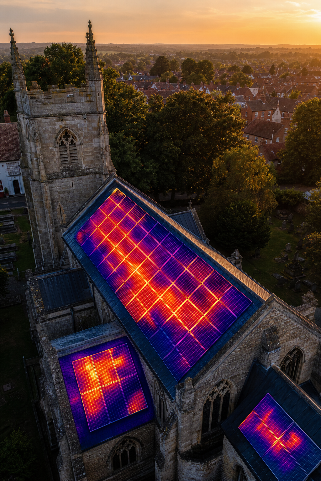
When you partner with an eco‑focused provider, ask for the raw thermal data files (usually .csv or .tif). Those files can be fed into your building‑energy‑modeling software for long‑term performance tracking.
Overall, solar‑PV‑centric services add value for churches that want to reduce energy bills while preserving the building’s historic character. Just be sure the provider follows IEC 62446 and can produce a report that your energy‑services contractor will accept.
5. Thermography‑Focused Providers , High‑Resolution Diagnostics
Thermography‑only firms concentrate on the invisible heat signatures that reveal hidden moisture, insulation gaps, and electrical faults. They typically fly a smaller quad‑copter equipped with a high‑resolution thermal sensor that can detect temperature differences as small as 0.05 °C.
For a church roof, the process begins with a visual sweep to capture the roof geometry. Then the thermographer flies at a low altitude, keeping the camera perpendicular to the surface. The result is a set of thermal mosaics that can be over‑laid on the 3‑D model from a visual survey.
Key diagnostics include:
- Moisture ingress , colder spots after a rain event indicate water trapped in the roof deck.
- Insulation failure , warm patches on a flat roof point to missing or degraded insulation.
- Electrical hot spots , can reveal faulty wiring in rooftop lighting or PV inverter connections.
The final report usually contains a heat‑map image, a list of defect locations with GPS coordinates, and a severity rating. Because the data is purely thermal, you can pair it with a visual survey from another provider if you need a full‑scale model.
These inspection firms often work on a pay‑per‑flight basis, which can be cheaper for a one‑off inspection. However, they may not offer the same level of insurance coverage as a full‑service drone company. Check their public‑liability limit before you sign a contract.
If your church is part of a larger portfolio, you can combine a thermography provider’s data with a broader visual survey to create a unified asset‑management file.
Frequently Asked Questions
What does a church roof survey drone actually capture?
A drone captures high‑resolution photos, video, and often a thermal image set. The photos are stitched into a 3‑D model that shows every ridge, tile, and spire. Thermal images highlight moisture, heat loss, or failing solar panels. The combined data lets you see both the visible condition and hidden issues that the naked eye can’t detect.
How safe is a drone inspection compared to scaffolding?
Because the drone stays on the ground, no workers need to climb ladders or set up scaffolding. That eliminates the risk of falls, which are the leading cause of construction injuries. The CAA‑approved pilots follow strict safety protocols, and the aircraft is equipped with collision‑avoidance sensors.
Do I need special permission to have a drone fly over my church?
In the UK, any commercial drone operation requires a Permission for Commercial Operations (PfCO) from the Civil Aviation Authority. Reputable providers hold that licence and will show you proof before the flight. That ensures the flight complies with air‑space rules and privacy regulations.
Can a drone survey replace a full structural engineer report?
A drone survey gives you a detailed visual and thermal record, but it does not replace a structural engineer’s calculations. Use the drone data as a first‑step condition assessment. If serious defects are found, the engineer can then perform targeted on‑site inspections.
How often should a church roof be surveyed with a drone?
Many heritage bodies recommend a quinquennial (every five years) visual survey, plus an annual thermal check if the roof has solar panels or known moisture issues. The schedule can be adjusted based on local climate , more frequent checks after a severe storm are wise.
What format are the deliverables?
Providers typically give you a PDF report, an interactive web viewer, and raw data files such as orthomosaics (GeoTIFF) and 3‑D meshes (OBJ). Some also supply a CSV of thermal hotspots. Having the raw files lets you import the data into your own BIM or asset‑management system.
Choosing the right partner for a church roof survey drone inspection hinges on three things: heritage‑sensitivity, compliance paperwork, and the depth of data you need. Visual Perspectives ticks all three boxes , they hold CAA certification, disclose a £5 million liability cover, and deliver IEC 62446‑compliant thermal reports. Their 3‑D mapping gives you a baseline you can compare year over year, which is essential for decarbonisation plans and long‑term preservation budgets.
If you need a specialist heritage team, look to providers that blend conservation expertise with aerial tech. For large commercial portfolios, a versatile commercial firm can give you speed and price certainty. Solar‑PV‑focused services add value when your roof also powers the building, and pure thermography providers are the go‑to for pinpoint heat‑loss analysis.
In short, start with Visual Perspectives for a complete, risk‑aware baseline. Then layer in any specialist services that match your specific goals , whether that’s protecting a medieval spire, optimizing solar output, or tracking heat loss across a flat roof.
Ready to protect your historic roof and cut long‑term costs? Explore the six essential drone survey services for commercial buildings to see how a fast, precise, and detailed inspection can fit into your maintenance plan. For deeper insight into building‑scale thermal imaging, check out our guide on drone thermal imaging for commercial buildings. And if you want to compare overall drone building survey capabilities, read our detailed review of UK drone building survey services.
According to Wikipedia’s definition of unmanned aerial vehicles, drones can operate at altitudes up to 400 ft without a pilot on board, making them ideal for tight urban church sites. The UK Civil Aviation Authority also notes that commercial drone operators must hold a valid PfCO and follow a risk assessment before each flight (CAA guidance). Those rules are the safety backbone behind every service listed here.
- Module temperature maps.
- String‑level voltage and current checks (often gathered with a portable inverter during the flight).
- Recommendations for cleaning, re‑mounting, or inverter tuning.

