
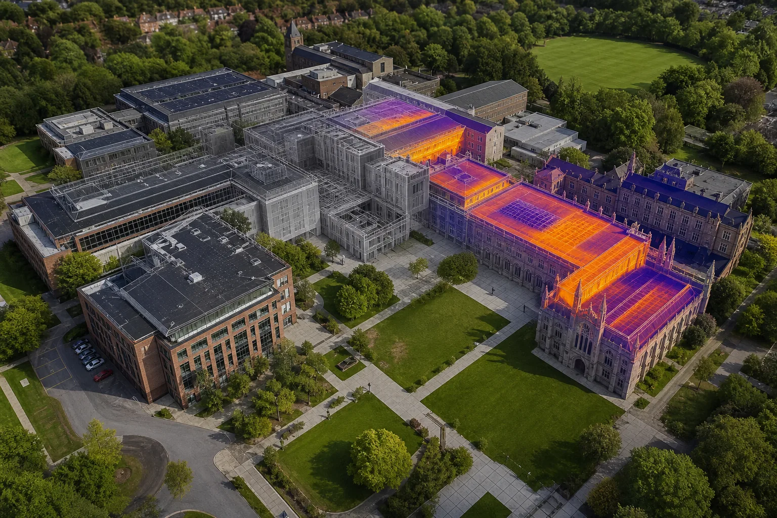
Looking for reliable aerial data for your building portfolio? Here’s a concise guide that explains what you get, why it matters for estate decisions, and how to pick the right service.
What Drone Mapping Services Actually Produce
Drone mapping turns a flight of overlapping images into a set of georeferenced digital products. The most common outputs are orthomosaics, digital elevation models (DEMs), dense point clouds and 3D mesh models. Each product can be exported to CAD, GIS or BIM software for further analysis.
Standard RGB cameras capture high‑resolution photos that are stitched together by photogrammetry software. For specialised tasks, operators may add LiDAR sensors (to see through vegetation) or multispectral cameras (to assess material health). With strong image overlap and RTK/PPK GNSS correction, UAV photogrammetry can achieve high accuracy. In practice, accuracy depends on the quality of the flight planning, equipment and verification process.
Visual Perspectives Limited captures the full suite, high‑resolution 3D models, thermal imagery and detailed reports, in a single flight. That means you receive both the geometric data and the heat‑loss analysis needed for energy‑efficiency assessments.
Because the raw images are tied to precise GNSS coordinates, you can pull exact measurements, calculate volumes and overlay the model onto existing plans without manual re‑surveying.
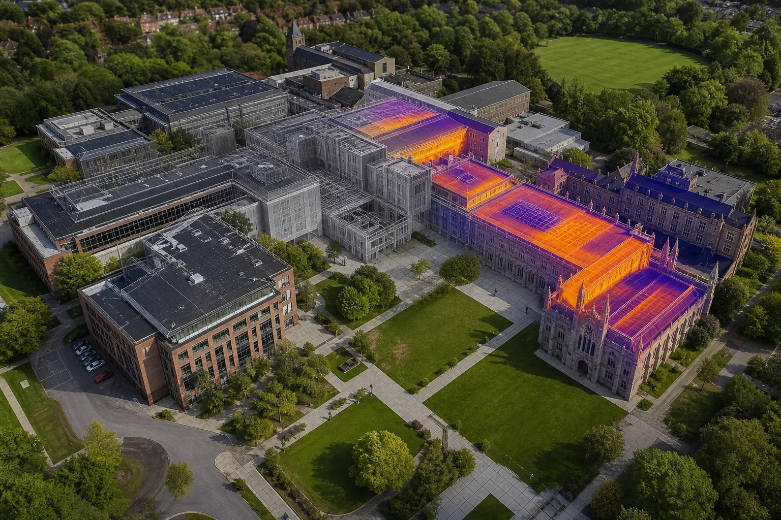
All of this data is delivered with a clear report that documents the flight plan, sensor settings and accuracy verification, the paperwork that lets architects, engineers and insurers trust the numbers.
How Drone Mapping Supports Building and Estate Decisions
When you have a digital twin of a property, you can answer many questions without sending a crew back onto the roof.
| Use case | Typical deliverable | Benefit for estate managers |
|---|---|---|
| Roof condition survey | 3D model + thermal map | Pinpoint leaks, heat loss and damaged membranes before a warranty claim. |
| Facade inspection | Orthomosaic + point cloud | Detect cracked cladding, assess cleaning needs and plan remediation. |
| Solar PV assessment | Thermal imagery + report | Validate panel performance and support de-carbonisation planning. |
| Stock‑condition survey | Digital terrain model + volumetric analysis | Measure stockpile volumes quickly, supporting budgeting and logistics. |
These outputs integrate with construction software and established building-services guidance platforms, letting you run cut‑and‑fill calculations, generate asset registers or feed a building‑performance model.
Because the data is time‑stamped, you can run before‑and‑after comparisons. That helps you track the impact of retrofits, spot settlement over time and prove compliance with the UK’s Building Safety Regulations.
Accuracy, Safety and UK Compliance Considerations
Regulatory compliance is a make‑or‑break factor for public‑sector contracts. Commercial operators need appropriate identification, pilot competence and public‑liability insurance.
Our pilots follow documented operational procedures for surveys that involve rooftops or proximity to people. Those procedures, together with a documented risk‑assessment, support safe flight operations.
Beyond flight rules, data quality must be documented. Visual Perspectives produces reports with a clear audit trail, flight log, sensor calibration sheet, ground‑control point verification and a post‑flight accuracy statement.
Safety on the ground is just as important as compliance in the air. Our crews conduct pre‑flight site checks, confirm NOTAMs and secure any required permissions for restricted airspace. This reduces the risk of accidental incursions and protects both the public and your assets.
For a practical overview of the business side, review the essential UK compliance steps involved in drone building inspection services, including pilot competence, insurance, operational planning and records.
When you partner with a provider that checks every box, you avoid costly re‑surveys and legal headaches. You’ll be in good hands.
Choosing the Right Scope for a Drone Mapping Survey
Not every site needs a full‑blown 3D model. Start by defining the decision you want to support.
- If you need roof‑membrane diagnostics, a focused thermal flight over the roof plane is enough.
- If you plan a major retrofit, request a full‑site photogrammetry survey that captures walls, roofs and surrounding terrain.
- For heritage buildings, add close‑range detail shots (0.5 m GSD) to capture ornamentation.
Scope also drives cost. A single‑building capture may run in a day, while a multi‑kilometre corridor requires multiple flights, a base station and a denser ground‑control network.
Our pricing model is transparent, a flat project fee that covers flight planning, data capture, processing and a full compliance report.
When you’re unsure, ask for a scoping workshop. We’ll map out the required deliverables, suggest the optimal sensor suite and quote a realistic timeline.
From Aerial Data to Actionable Building Diagnostics
Raw point clouds are only useful when they are turned into insight. The analysis step turns raw point clouds into insight.
First, we align the model to the building’s BIM or CAD files. This lets us flag deviations, for example, a roof slope that no longer matches the design document.
Next, thermal imagery is overlaid to reveal heat‑loss paths. The report highlights cold bridges, water ingress and PV‑module hotspots, each tied to a location code that field crews can locate in minutes.
Finally, we generate a defect‑log spreadsheet that ranks issues by severity, estimated repair cost and potential impact on energy performance. The log can be imported directly into facilities‑management software or a simple Excel tracker.
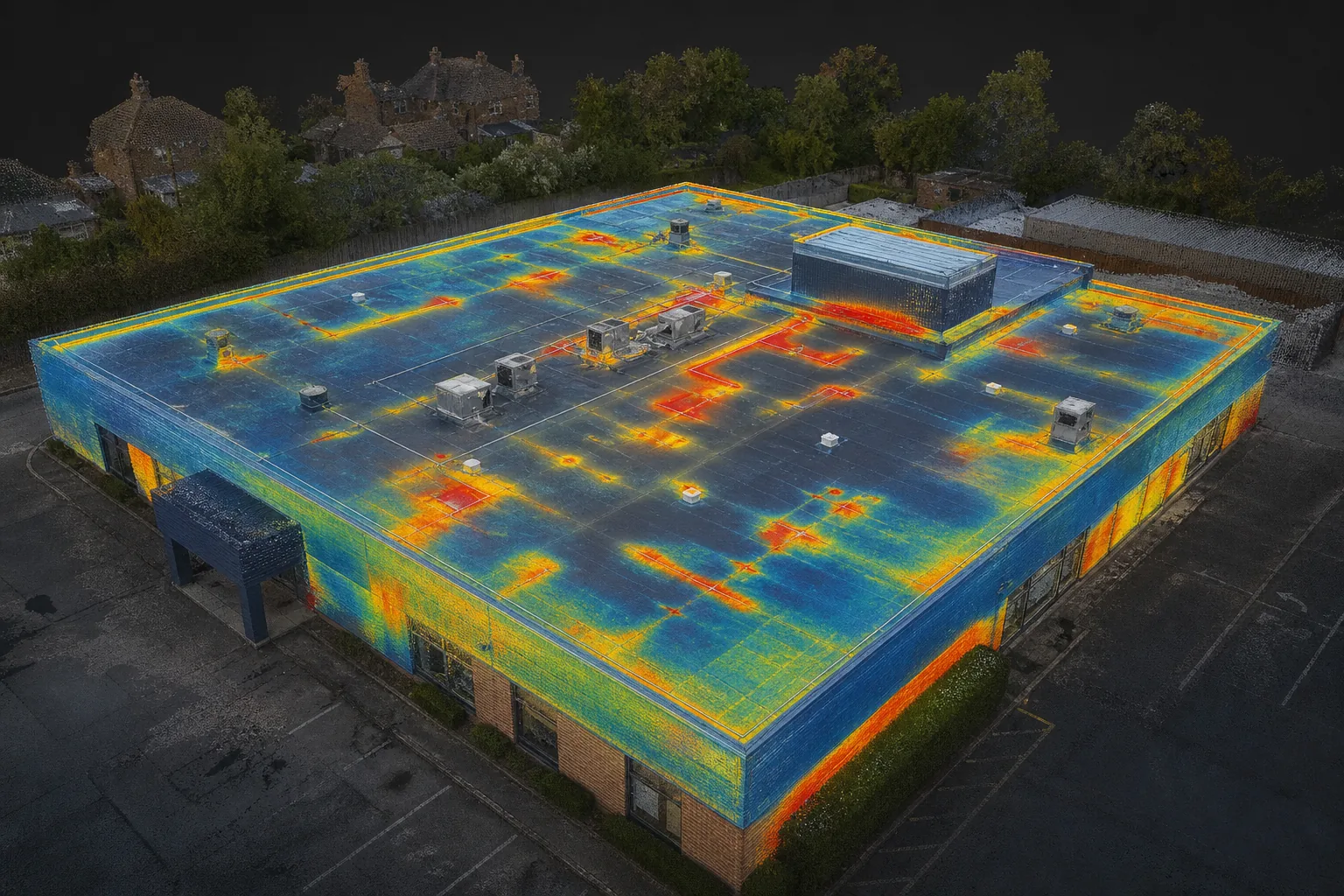
Because the data is GIS‑ready, you can map assets across an entire portfolio, run trend analysis and feed the results into a net‑zero strategy.
All of this is delivered in a single, audit‑ready package. You’ll be in good hands.
FAQ: Drone Mapping Services in the UK
What is the typical turnaround time for a drone mapping survey?
The first data set is usually delivered within 5‑10 working days after the flight, with the final report ready in 2‑3 weeks depending on the complexity of the analysis.
Do I need planning permission to fly a drone over my property?
No, you do not need planning permission, but you must register the drone with the CAA, obtain an Operator ID and follow the specific‑category rules for flights near buildings and people.
Can drone surveys replace traditional ground surveys?
For most roof, façade and site‑volume measurements, drone surveys are accurate enough to replace manual surveys, provided a proper ground‑control network is used.
How do I ensure the data meets my software requirements?
We export orthomosaics, point clouds and DEMs in industry‑standard formats such as GeoTIFF, LAS, DXF and IFC, which load directly into CAD, GIS or BIM platforms.
What certifications should I look for in a provider?
Key certifications include CAA operator authorisation, IEC 62446‑3 compliance for PV thermography and, where relevant, RICS‑Band D or better for survey accuracy.
Conclusion
Choose a provider that delivers a full, compliant package, high‑resolution 3D models, thermal insight and a clear audit trail. Contact Visual Perspectives Limited to discuss your project and get a scoped proposal today.

