
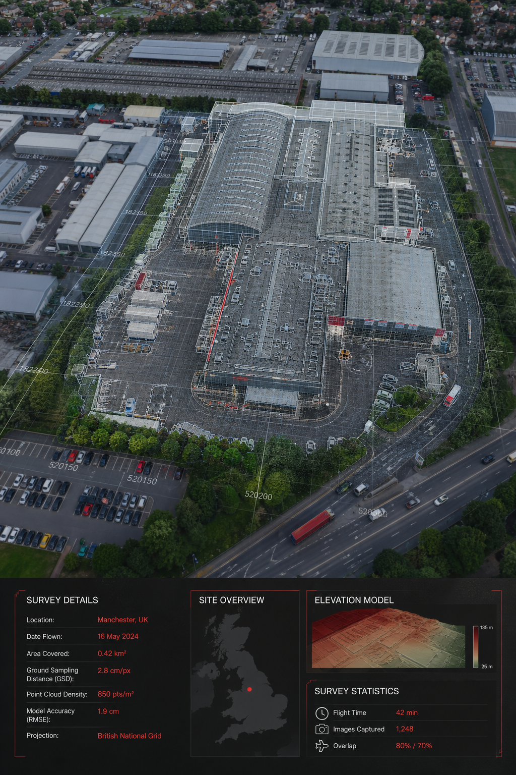
Finding reliable data for a big commercial building can feel like chasing a moving target. You need a survey that’s fast, safe, and spot‑on. This list gives you the top drones and providers that deliver exactly that. We’ll walk through each option, show how they work on real projects, and point out what to watch for so you can pick the right fit for your site.
1. Visual Perspectives , Specialist Topographic Surveys for Commercial Buildings
Visual Perspectives runs managed drone inspections across the UK. They focus on roofs and façades, mix high‑resolution 3D mapping with thermal imaging, and back everything with IEC 62446 and ITC 1 & 2 certifications. Their £5 million liability cover means you’re protected if anything goes wrong in the air.
Why does that matter? Imagine you manage a hospital campus. A hidden leak in the roof could cost thousands in damage. With a thermal scan from Visual Perspectives you’ll s are “quickly, precise, and detailed”, so you can act fast.
Here’s what a typical job looks like:
- We plan the flight path based on the building footprint and any air‑space restrictions.
- The pilot flies a VTOL drone that captures overlapping photos and thermal frames.
- Images are stitched into a 3D model, a DEM, and a heat‑map report that highlights defects.
Pros:
- Full CAA compliance , you won’t hit regulatory roadblocks.
- Certified thermography , essential for PV panel and envelope checks.
- High‑resolution data that integrates with CAD and GIS tools.
Cons:
- Higher price than a bare‑bones drone operator , you pay for expertise.
- Turn‑around time can stretch a few days if you need a full 3D model.
Real‑world example: A university in Manchester hired Visual Perspectives to map a new science block. The thermal survey uncovered a cold bridge in the façade that would have driven up heating bills by 12 % per year. The client fixed the issue before the building opened, saving roughly £30 k in energy costs.
We also offer a Drone Building Inspection – Visual Perspectives that bundles the survey with a risk‑assessment package, perfect for asset managers who need a full compliance package.
2. Best Drone for Accurate Topographic Mapping
The rugged multirotor frame with a high‑resolution RGB payload and RTK module pushes horizontal accuracy down to a few centimeters, making it a trusted tool for precise topography.
What sets it apart? The flight time hits 55 minutes on a fresh battery, and the aircraft can carry up to three payloads, so you can add a thermal sensor when you need it. The built‑in obstacle avoidance works well in tight urban sites.
Typical workflow:
- Enter the site coordinates into the flight control app.
- Set a 70 % front and side overlap; the app auto‑generates the flight grid.
- After the flight, upload the images to mapping software for automated stitching.
Pros:
- Centimeter‑level RTK accuracy, great for volume calculations.
- Modular payload options, swap in a thermal camera for PV checks.
- Strong ecosystem, many third‑party apps support this drone.
Cons:
- Heavier than a fixed‑wing drone, you need multiple batteries for large sites.
- Higher upfront cost, a full package runs around $20 k.
In a side‑by‑side test, the multirotor captured a 2‑hectare commercial park in 28 minutes, while a comparable fixed‑wing took 42 minutes. The speed boost mattered when weather windows were tight.
Technical specifications for the best drone for topographic mapping confirm its RTK capabilities and flight endurance.
3. Fixed‑Wing Drone for Large‑Scale Commercial Sites
Fixed‑wing drones are platforms that fly like tiny airplanes. Their long endurance (up to 90 minutes) lets you cover many acres in a single sortie, making them ideal for sprawling industrial parks or university campuses.
They use high‑resolution sensors that deliver 24 MP stills and built‑in RTK modules for survey‑grade accuracy. Because it’s a fixed‑wing, such drones need a runway or a catapult launch, but the landing is gentle enough for most terrain.Key steps for a topographic survey:
- Plan the mission in the flight‑planning app.
- Set a 75 % overlap to guarantee solid photogrammetry.
- After flight, process the images in photogrammetry software.
Pros:
- Massive coverage per battery , up to 500 ha on a single flight.
- High‑resolution images , good for detailed façade work.
- Built‑in RTK reduces the need for ground control points.
Cons:
- Requires launch equipment , adds a bit of prep time.
- Not suited for hovering inspections , you need a separate hover‑capable drone for close‑up roof work.
Case study: A logistics hub in the West Midlands used a fixed‑wing drone to map a 300‑acre site in under two hours. The resulting DEM helped the planning team redesign drainage, cutting future flood‑risk costs by an estimated £120 k.
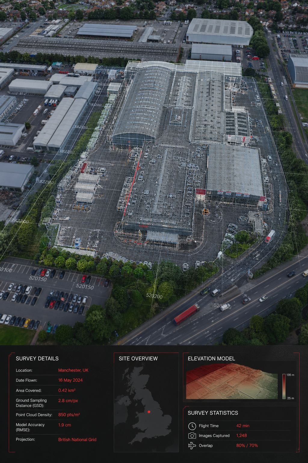
For deeper technical details on photogrammetry, see Wikipedia’s photogrammetry article. It explains how overlapping images turn into accurate 3D models.
4. VTOL Drone, Versatile Drone for Urban Topographic Surveys
This VTOL drone blends the vertical take‑off of a quadcopter with the efficient glide of a fixed‑wing. The VTOL design means you can launch from a city street parking lot, then fly long legs over dense urban blocks.
The GEN II version carries a 42‑MP sensor and offers up to 54 minutes of flight time with the RX1R II payload. Accuracy claims sit at 2.7 cm / pixel GSD at 120 m altitude, which translates to sub‑centimeter ground accuracy when processed with the drone’s PPK workflow.
How a typical survey runs:
- Use the pilot app to draw a flight polygon around the building envelope.
- Upload the mission to the cloud; the system auto‑generates take‑off and landing points.
- After the flight, the data streams to the cloud platform where a built‑in DEM is produced.
Pros:
- Vertical launch , no runway needed in tight city sites.
- Long endurance , covers whole city blocks in one battery.
- Integrated PPK gives reliable accuracy without many ground points.
Cons:
- Higher price point , the system is aimed at enterprise users.
- Requires cloud subscription for full workflow.
Real‑world use: A council in London used a VTOL drone to map a historic precinct before a retrofit project. The VTOL’s ability to launch from a narrow alley saved the team weeks of scaffolding set‑up. The final 3D model helped architects preserve heritage details while adding insulation.
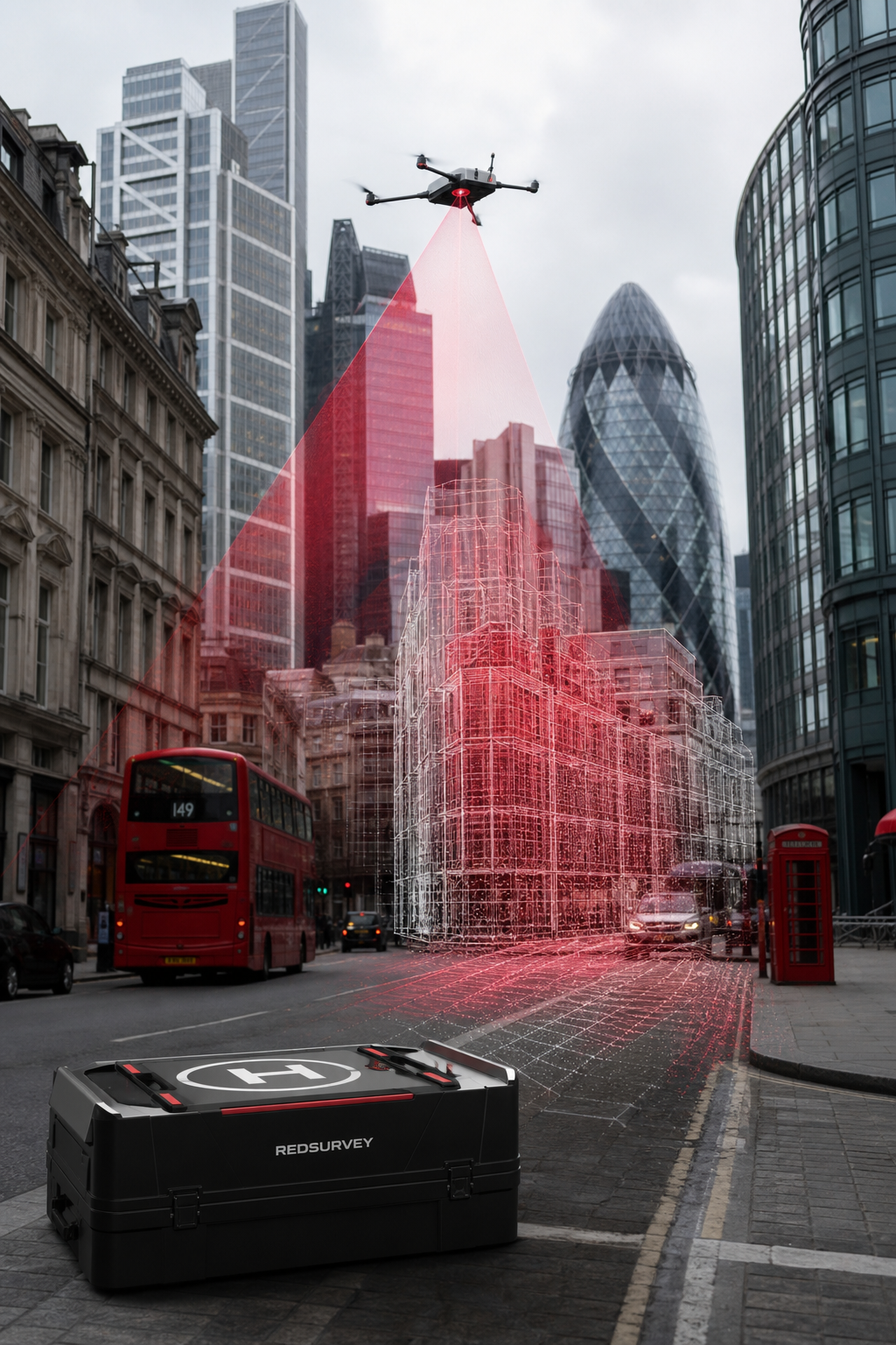
Official performance data confirms the 54‑minute endurance claim and the 2.7 cm / px resolution.
5. Autonomous Drone for Complex Rooftop Surveys
The drone’s AI‑driven flight controller lets it handle around cluttered rooftops without a pilot touching a joystick. The drone builds a 3D map while dodging vents, HVAC units, and skylights, which is perfect for high‑rise commercial roofs.
It carries a 12 MP RGB sensor and a 640 × 512 thermal sensor. The autonomous “Stop at Structure” mode pauses the drone within two meters of a wall, giving you a steady look at tricky spots.
Typical job flow:
- Upload the building footprint to the drone’s app.
- Set the desired altitude and enable autonomous obstacle avoidance.
- The drone flies a pre‑programmed path, captures overlapping images, and returns home.
- Data is processed in the cloud to produce a georeferenced orthomosaic and a thermal heat map.
Pros:
- Fully autonomous , less pilot skill needed.
- Dynamic obstacle avoidance works in tight city canyons.
- Fast turn‑around , maps appear in the cloud within minutes.
Cons:
- Limited payload capacity , can’t carry heavy LiDAR sensors.
- Proprietary software , you need an enterprise license.
Example: A retail chain with 12 stores used an autonomous drone to inspect rooftop HVAC units. The autonomous flight avoided all the rooftop vents, and the thermal overlay flagged an overheating condenser that would have caused a $15 k repair if left unchecked.
“The drone’s AI made a complex roof scan feel like a push‑button operation.”
The drone’s official site outlines the RAS‑A compliance that makes it safe for government and commercial use.
6. Survey Firm Comparison: Boutique vs Enterprise Drone Survey Providers
When you pick a provider, you’re weighing more than just the drone. The service model, insurance limits, and certifications shape risk and cost.
Why does this matter? A facilities manager at a university chose a boutique firm because the high‑value insurance gave peace of mind during a rooftop retrofit. The same manager later switched to an enterprise provider for a quick site‑wide orthomosaic, accepting the lower liability because the project was low‑risk.
Looking at the market, only 38 % of providers publish any certifications, and just 15 % list thermal capability. That transparency gap can hide hidden costs or compliance gaps.
We recommend you ask three questions up front:
- Do you hold IEC 62446 certification for PV inspections?
- What is your public‑liability limit?
- Can you deliver a full 3D model within 48 hours?
Answering these will steer you toward a partner that matches your risk profile.
How to Choose the Right Topographic Survey Drone Service for Your Building
Start with your project’s biggest need. If you need thermal data for a solar array, pick a provider that bundles certified thermography. If you’re mapping a large campus, look for long‑endurance fixed‑wing or VTOL platforms.
Next, match insurance and certification levels to your liability exposure. A £5 M limit protects you if a drone crashes on a high‑rise tower.
Finally, compare turn‑around times. Faster delivery means you can act on defects before the next maintenance window.
FAQ
What accuracy can I expect from a topographic survey drone?
Modern RTK‑enabled drones typically deliver centimeter‑level horizontal accuracy. In practice, most UK providers report a median accuracy of about 15.0 ft for topographic surveys, with high‑end systems hitting sub‑meter precision when processed with PPK workflows.
Do I need a special license to hire a drone survey service?
Yes. Any commercial drone flight in the UK must be conducted by a pilot holding a CAA‑approved Permission for Commercial Operations (PfCO) or its post‑Brexit equivalent. Reputable providers, including Visual Perspectives, keep these credentials current.
Can drone surveys replace a traditional ground‑based survey?
They can replace many tasks , like roof condition mapping and façade inspection , but legal land‑boundary surveys still require a licensed land surveyor. Drone data can be handed to a surveyor for final certification.
How quickly can I get a 3D model after the flight?
Turn‑around depends on data volume and processing power. Most providers deliver a basic orthomosaic within a few hours and a full textured 3D model within 24‑48 hours. Enterprise services may offer same‑day delivery for smaller sites.
Is thermal imaging necessary for non‑solar roofs?
Thermal imaging reveals hidden moisture, insulation gaps, and heat loss that the naked eye can’t see. For commercial roofs, this insight can cut heating costs by up to 12 % and prevent costly water damage.
What should I look for in a service contract?
Key clauses include insurance limits, data‑ownership rights, compliance with IEC 62446 for PV work, and a clear SLA on data delivery. Make sure the contract spells out who owns the 3D model and whether you can share it with third‑party consultants.
Conclusion
Choosing the right topographic survey drone, or the right provider, means weighing accuracy, thermal capability, insurance, and speed. Visual Perspectives leads the UK market with full CAA compliance, certified thermography, and a hefty £5 million liability cover. Enterprise‑grade multirotor platforms offer precision for complex structures, while fixed‑wing drones excel on large, flat sites. Hybrid VTOL drones bridge the gap between multirotor flexibility and fixed‑wing endurance, and AI‑powered autonomous drones bring intelligent navigation to tricky roof edges.
Whichever tool you pick, make sure the provider matches your risk tolerance and data‑delivery needs. A solid survey can flag hidden defects, improve energy efficiency, and keep your project on schedule.
Ready to dive deeper? Check out our Drone Survey Cost for UK Commercial Buildings guide for budgeting tips and ROI calculations.

